
District Kroměříž Elevation 386 m | Postal code 768 71 Area 3.78 km² | |
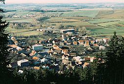 | ||
Podhradní Lhota is a village and municipality (obec) in Kroměříž District in the Zlín Region of the Czech Republic.
Map of 768 71 Podhradn%C3%AD Lhota, Czechia
The municipality covers an area of 3.78 square kilometres (1.46 sq mi), and has a population of 519 (as at 25 February 2008).
Podhradní Lhota lies approximately 33 kilometres (21 mi) north-east of Kroměříž, 23 km (14 mi) north-east of Zlín, and 254 km (158 mi) east of Prague.
References
Podhradní Lhota Wikipedia(Text) CC BY-SA