
Area 349.6 km² Population 7,577 (2013) | Website pleasantscountywv.net Founded 1851 County seat St. Marys Cities St. Marys, Belmont | |
 | ||
Rivers Ohio River, Middle Island Creek, McKim Creek, Bull Creek | ||
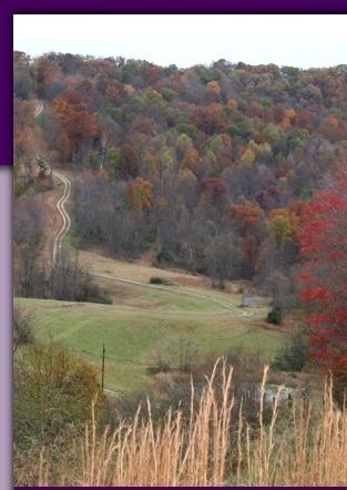
Pleasants county west virginia come check us out
Pleasants County is a county located in the U.S. state of West Virginia. At the 2010 census, the population was 7,605, making it the third-least populous county in the state. Its county seat is St. Marys. The county was created by the Virginia General Assembly in 1851 and named for US Senator and Virginia Governor James Pleasants, Jr..
Contents
- Pleasants county west virginia come check us out
- Map of Pleasants County WV USA
- Geography
- Major highways
- Adjacent counties
- National protected area
- 2000 census
- 2010 census
- Education
- Politics
- Cities
- Unincorporated communities
- References
Map of Pleasants County, WV, USA
Geography
According to the U.S. Census Bureau, the county has a total area of 135 square miles (350 km2), of which 130 square miles (340 km2) is land and 4.4 square miles (11 km2) (3.3%) is water. It is the fourth-smallest county in West Virginia by area.
Major highways
Adjacent counties
National protected area
2000 census
As of the census of 2000, there were 7,514 people, 2,887 households, and 2,136 families residing in the county. The population density was 58 people per square mile (22/km²). There were 3,214 housing units at an average density of 25 per square mile (9/km²). The racial makeup of the county was 98.30% White, 0.48% Black or African American, 0.47% Native American, 0.20% Asian, 0.07% from other races, and 0.49% from two or more races. 0.37% of the population were Hispanic or Latino of any race.
There were 2,887 households out of which 32.70% had children under the age of 18 living with them, 60.10% were married couples living together, 10.40% had a female householder with no husband present, and 26.00% were non-families. 22.90% of all households were made up of individuals and 12.30% had someone living alone who was 65 years of age or older. The average household size was 2.51 and the average family size was 2.93.
In the county, the population was spread out with 23.80% under the age of 18, 7.80% from 18 to 24, 28.70% from 25 to 44, 24.80% from 45 to 64, and 14.90% who were 65 years of age or older. The median age was 39 years. For every 100 females there were 100.20 males. For every 100 females age 18 and over, there were 96.20 males.
The median income for a household in the county was $32,736, and the median income for a family was $37,795. Males had a median income of $31,068 versus $18,077 for females. The per capita income for the county was $16,920. About 10.90% of families and 13.70% of the population were below the poverty line, including 17.80% of those under age 18 and 7.90% of those age 65 or over.
2010 census
As of the 2010 United States Census, there were 7,605 people, 2,861 households, and 2,021 families residing in the county. The population density was 58.5 inhabitants per square mile (22.6/km2). There were 3,390 housing units at an average density of 26.1 per square mile (10.1/km2). The racial makeup of the county was 97.3% white, 1.3% black or African American, 0.2% American Indian, 0.1% Asian, 0.1% from other races, and 1.0% from two or more races. Those of Hispanic or Latino origin made up 0.8% of the population. In terms of ancestry,
Of the 2,861 households, 31.0% had children under the age of 18 living with them, 56.1% were married couples living together, 9.8% had a female householder with no husband present, 29.4% were non-families, and 24.9% of all households were made up of individuals. The average household size was 2.44 and the average family size was 2.90. The median age was 42.4 years.
The median income for a household in the county was $38,882 and the median income for a family was $54,391. Males had a median income of $52,738 versus $23,750 for females. The per capita income for the county was $18,770. About 6.7% of families and 13.7% of the population were below the poverty line, including 12.6% of those under age 18 and 10.8% of those age 65 or over.
Education
In Pleasants County, there is a single school district including one high school, one middle school, and two elementary schools. The county is also served by the Mid Ohio Valley Technical Institute, which offers vocational education in a variety of fields.
Politics
In the 2008 presidential election, 60% of the county's vote went to Senator John McCain, while 38% went to Barack Obama.