
Country United States County Linn Time zone Central (CST) (UTC-6) Elevation 262 m Population 1,187 (2013) Area code 913 | Established 1869 FIPS code 20-56450 Zip code 66075 Local time Tuesday 4:42 PM | |
 | ||
Weather 16°C, Wind NE at 29 km/h, 44% Humidity Area 5.309 km² (4.662 km² Land / 65 ha Water) | ||
How to say or pronounce usa cities pleasanton kansas
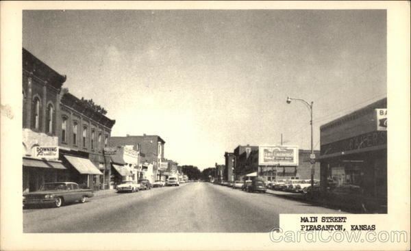
Pleasanton is a city in Linn County, Kansas, United States. As of the 2010 census, the city population was 1,216.
Contents
- How to say or pronounce usa cities pleasanton kansas
- Map of Pleasanton KS 66075 USA
- History
- Geography
- Climate
- 2010 census
- 2000 census
- Education
- Museums
- Media
- Notable people
- References
Map of Pleasanton, KS 66075, USA
History
In 1864, General Alfred Pleasonton defeated the Confederates in the Battle of Mine Creek near present-day Pleasanton. This battle, involving 25,000 men, resulted in a Union victory which ended the threat of Confederate invasion in Kansas.
Pleasanton had its start in the year 1869 by the building of the railroad through that territory. It was named in honor of General Alfred Pleasonton, though the city name is spelled differently.
The first post office in Pleasanton was established in August 1869.
Geography
Pleasanton is located at 38°10′35″N 94°42′43″W (38.176326, -94.711997). According to the United States Census Bureau, the city has a total area of 2.05 square miles (5.31 km2), of which, 1.80 square miles (4.66 km2) is land and 0.25 square miles (0.65 km2) is water.
Pleasanton is approximately 67 miles (108 km) south of Kansas City.
Climate
The climate in this area is characterized by hot, humid summers and generally mild to cool winters. According to the Köppen Climate Classification system, Pleasanton has a humid subtropical climate, abbreviated "Cfa" on climate maps.3.
2010 census
As of the census of 2010, there were 1,216 people, 528 households, and 324 families residing in the city. The population density was 675.6 inhabitants per square mile (260.9/km2). There were 607 housing units at an average density of 337.2 per square mile (130.2/km2). The racial makeup of the city was 95.0% White, 0.7% African American, 0.4% Native American, 0.5% Asian, 0.2% Pacific Islander, 1.3% from other races, and 2.0% from two or more races. Hispanic or Latino of any race were 2.9% of the population.
There were 528 households of which 30.9% had children under the age of 18 living with them, 43.0% were married couples living together, 13.6% had a female householder with no husband present, 4.7% had a male householder with no wife present, and 38.6% were non-families. 34.8% of all households were made up of individuals and 20.3% had someone living alone who was 65 years of age or older. The average household size was 2.30 and the average family size was 2.97.
The median age in the city was 38 years. 26.6% of residents were under the age of 18; 8.1% were between the ages of 18 and 24; 23.7% were from 25 to 44; 24.1% were from 45 to 64; and 17.5% were 65 years of age or older. The gender makeup of the city was 45.1% male and 54.9% female.
2000 census
As of the census of 2000, there were 1,387 people, 562 households, and 384 families residing in the city. The population density was 846.8 people per square mile (326.5/km²). There were 617 housing units at an average density of 376.7 per square mile (145.3/km²). The racial makeup of the city was 97.76% White, 0.65% African American, 0.50% Native American, 0.07% Asian, 0.14% from other races, and 0.87% from two or more races. Hispanic or Latino of any race were 0.65% of the population.
There were 562 households out of which 30.6% had children under the age of 18 living with them, 55.0% were married couples living together, 10.0% had a female householder with no husband present, and 31.5% were non-families. 26.9% of all households were made up of individuals and 14.9% had someone living alone who was 65 years of age or older. The average household size was 2.47 and the average family size was 2.99.
In the city, the population was spread out with 26.9% under the age of 18, 10.6% from 18 to 24, 24.4% from 25 to 44, 22.1% from 45 to 64, and 16.1% who were 65 years of age or older. The median age was 37 years. For every 100 females there were 91.8 males. For every 100 females age 18 and over, there were 94.6 males.
The median income for a household in the city was $25,714, and the median income for a family was $32,014. Males had a median income of $24,917 versus $18,333 for females. The per capita income for the city was $13,309. About 18.8% of families and 21.5% of the population were below the poverty line, including 27.5% of those under age 18 and 12.4% of those age 65 or over.
Education
Museums
Media
Local networks that serve the Linn County, Kansas area include KCTV 5, Kansas City 41 Action News, KMBC-TV, WDAF-TV, The Four States Network, and KTWU-Topeka.