
- summer (DST) CEST (UTC+2) Area 62.14 km² | Elevation 216 m Local time Wednesday 2:44 AM | |
 | ||
Weather 6°C, Wind NE at 2 km/h, 91% Humidity Points of interest Kančí propast, Zvonivá jama, Gerlašské skaly | ||
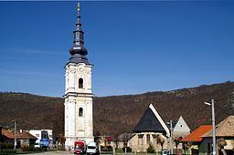
Plešivec is a large village and municipality in the Rožňava District in the Košice Region of middle-eastern Slovakia.
Contents
- Map of 049 11 PleC5A1ivec Slovakia
- History
- Geography
- Economy and facilities
- Government
- Culture
- Transport
- References
Map of 049 11 Ple%C5%A1ivec, Slovakia
History
In historical records the village was first mentioned in 1243.
Geography
The village lies at an altitude of 218 metres and covers an area of 62,142 km². It has a population of about 2440 people.
Economy and facilities
The village has a petrol station and a guesthouse. It also has a number of quality medical facilities including a pharmacy, a doctors surgery and outpatient facilities for children and adolescents. The village also has a commercial bank, an insurance company and a cashomat.
Government
The village has its own birth registry office and its own police force
Culture
The village has a public library, a gymnasium and a football pitch.
Transport
The village has its own railway station.