
Area 21.19 km² | Local time Tuesday 5:41 PM | |
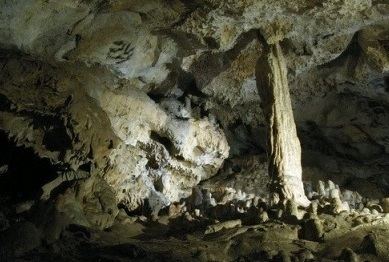 | ||
Weather 14°C, Wind E at 5 km/h, 56% Humidity Points of interest Burg Blasenstein, Pohanská, Roštún, Plavecká jaskyňa | ||
Plavecké Podhradie is a village and municipality in western Slovakia in the Malacky District in the Bratislava region.
Contents
- Map of 906 36 PlaveckC3A9 Podhradie Slovakia
- History
- Geography
- Population
- Sights
- Plavecky castle remains
- References
Map of 906 36 Plaveck%C3%A9 Podhradie, Slovakia
History
In historical records the village was first mentioned in 1247 AD.
Geography
The village lies at an altitude of 256 metres and covers an area of 21.188 km².
Population
On 31 December 2011, it had a population of 686 people.
Sights
The Plavecky Castle and few caves in the Little Carpathians are located nearby.
Plavecky castle (remains)
Original Castle was built in the 13th century. Middle part consisted of gothic castle:rectangular tower and the palace. In the 16th century it was expensively rebuilt into renaissance fortress with low courtyards. It was continually fortiefied and maintained during the 17th century, when new cannon bastions were built. In 1706 it was damaged by army and so became dilapidated in the 18th century. The remains are visible from surrounding environment, part of Zahorie district can be seen from the remains. Water font is located near the remains.