Area 16,975 km² | Capital Atakpamé Team Anges FC | |
 | ||
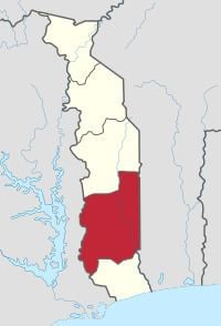
Plateaux is one of Togo's five regions.
Map of Plateaux Region, Togo
Atakpamé is the regional capital. It is the largest region in terms of area and has the second largest population (after the Maritime Region). Other major cities in the Plateaux region include Kpalimé and Badou.
Plateaux is located north of Maritime Region and south of Centrale Region. In the west, it borders the Volta Region of Ghana, and in the east it borders three departments of Benin: Collines to the northeast; Zou to the east; and Kouffo to the southeast.
Plateaux is divided into the prefectures of:
References
Plateaux Region, Togo Wikipedia(Text) CC BY-SA
