
Country Philippines Established 1850 Time zone PST (UTC+8) Province Surigao del Norte | Region Caraga (Region XIII) Barangays Area 61.29 km² Local time Tuesday 12:26 PM | |
 | ||
District 2nd district of Surigao del Norte Weather 28°C, Wind N at 8 km/h, 73% Humidity Neighborhoods Anislagan, Pananay-an, Mabini, Sta. Cruz, Bad-as | ||
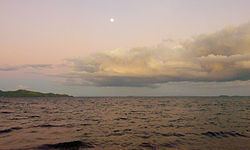
April 3 2016 interview in bad as highway placer surigao del norte with mamanwa tribe
Placer is a fourth class municipality in the province of Surigao del Norte, Philippines. According to the 2015 census, it has a population of 27,094 people.
Contents
- April 3 2016 interview in bad as highway placer surigao del norte with mamanwa tribe
- Map of Placer Surigao del Norte Philippines
- World War II
- Barangays
- References
Map of Placer, Surigao del Norte, Philippines
World War II
After the Japanese obtained the surrender of American and Filipino troops on Mindanao in May and June 1942, Placer, along with much of Mindanao, remained free of Japanese occupation. In late September 1943 Japanese troops landed and occupied Placer. Their goals seemed to be to fill drums with oil from a storage tank there for their use and to search for lumber. About 300 to 400 Japanese troops were in town. Some began moving south toward Claver. On October 10 guerrillas under American leadership attacked with 135 men from both the north and south to dislodge the Japanese from Placer. This attack failed, leaving the town in Japanese hands.
Barangays
Placer is politically subdivided into 20 barangays. In 1956, the sitios of Sta. Cruz, Anislagan, Alangalang, Soyoc, and Pananay-an were converted into barrios, while barrio Macalaya was divided into Upper and Lower Macalaya.