
Country United States Time zone Eastern (EST) (UTC-5) Local time Monday 7:22 PM | State North Carolina Elevation 394 ft (120 m) ZIP codes 27228, 27312 Population 3,962 (2013) | |
 | ||
Weather 17°C, Wind S at 5 km/h, 32% Humidity Points of interest Carolina Tiger Rescue, Chatham Historical Museum, Kiwanis Park, Town Lake Park, Page Vernon Park | ||
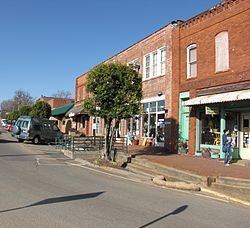
Exploring pittsboro north carolina
Pittsboro is a town in Chatham County, North Carolina, United States. The population was 3,743 at the 2010 census. It is the county seat of Chatham County.
Contents
- Exploring pittsboro north carolina
- Map of Pittsboro NC 27312 USA
- History
- Local currency the PLENTY
- Chatham County Courthouse fire
- City government
- Educational facilities
- Media outlets
- Geography
- Demographics
- Economy
- National Register of Historic Places listings
- Notable people
- References
Map of Pittsboro, NC 27312, USA
History
Pittsboro was established as a town in 1785. The Chatham County Court House stood on land belonging to Mial Scurlock; however, in 1787, the legislature declared that a town could not be established on Scurlock's land. The town's trustees instead purchased adjacent land belonging to William Petty and laid out the town. That same year, Pittsboro was officially named the county seat. Although Chatham County is named for William Pitt, 1st Earl of Chatham, Pittsboro is named for his son, William Pitt the Younger.
Pittsboro was once considered as a potential site for both the University of North Carolina and the state capitol. The university was eventually sited in Chapel Hill, while the state capitol was located 34 miles (55 km) to the east of Pittsboro, in Raleigh.
Local currency: the PLENTY
Some citizens of Pittsboro have revitalized a local form of currency called the PLENTY. It was created in 2002. In 2009, it was being exchanged at a local bank at the rate of $9 for every $10 of PLENTY. The currency failed to gain traction during both releases.
Chatham County Courthouse fire
On March 25, 2010, the Chatham County Courthouse (pictured above), while undergoing a $415,000 exterior renovation, caught fire. Smoke was first reported in the area around 4:15 p.m.; the fire was dispatched to the Pittsboro Fire Department around 4:45 p.m. By 5 p.m., smoke was reported to be rising from out of the clock tower, which was surrounded by scaffolds. The building was evacuated safely.
The building suffered severe damage to the clock tower and the third floor. It was reported that the fire had destroyed all the computers and records, but that there are offsite copies and the information should be recoverable.
On March 26, 2010, at approximately 1:30 a.m., the clock tower collapsed onto the main building, but the building as whole was only damaged on the second floor, and only had water and smoke damage throughout the rest of the building. Overall 11 fire departments participated in the fire efforts.
The fire marshal's investigation into the fire determined that it was caused by a soldering torch that ignited wood near the soffit. Workers attempted to extinguish the blaze, but were unsuccessful in their efforts. On Wednesday, March 31, 2010, the Chatham County Commissioners voted in favor of rebuilding the courthouse. The courthouse officially reopened on April 20, 2013.
City government
The mayor of Pittsboro is Cindy S. Perry. The town's Board of Commissioners consists of Pamela Baldwin, J.A. (Jay) Farrell, Bett Wilson Foley, John Bonitz, and Michael A. Fiocco. The town manager is Bryan Gruesbeck.
Pittsboro Police is currently under administration by Chief Percy Crutchfield. Serving the 3000 residents of Pittsboro, the department consists of 8 patrolmen, 1 community police officer, 1 lead investigator and 1 lieutenant.
Educational facilities
The town is served by four local schools and a Central Carolina Community College campus:
Media outlets
Geography
Pittsboro is located east of the center of Chatham County at 35°43′13″N 79°10′35″W (35.720332, -79.176393).
According to the United States Census Bureau, the town has a total area of 4.2 square miles (10.8 km2), of which 4.1 square miles (10.7 km2) is land and 0.04 square miles (0.1 km2), or 0.86%, is water.
U.S. Highways 15 and 501 run concurrently through the center of the town as Hillsboro Street and Sanford Road, leading north 17 miles (27 km) to the center of Chapel Hill and the University of North Carolina, and south 17 miles (27 km) to Sanford. U.S. Route 64 bypasses Pittsboro to the north and leads east 34 miles (55 km) to Raleigh and west 16 miles (26 km) to Siler City. U.S. Route 64 Business passes through the town as West Street and East Street, crossing US 15/501 at the traffic circle that surrounds the historic Chatham County Courthouse in the center of town. North Carolina Highway 87 leads northwest from Pittsboro 32 miles (51 km) to Burlington.
Near the geographic center of the state, Pittsboro is 150 miles (240 km) from Wilmington at the coast and the same from Boone in the Blue Ridge Mountains.
Jordan Lake is 8 miles (13 km) east, providing recreation, fishing, boating and scenic panoramas. The lake is 14,000 acres (5,700 ha) of surface and provides water for Raleigh and the town of Cary.
Demographics
2010 Census The Census of 2010 shows a population of 3,743, 68% growth since 2000. The racial makeup of the town was: 72% White, 19% African American, 4% some other race alone, 2% two or more races. Almost 9% of the population was Hispanic or Latino. 54% of the population is female and 46% male.
2000 Census As of the census of 2000, there were 2,226 people, 855 households, and 535 families residing in the town. The population density was 663.1 people per square mile (255.8/km²). There were 939 housing units at an average density of 279.7 per square mile (107.9/km²). The racial makeup of the town was 64.38 percent White, 27.54 percent African American, 0.49 percent Native American, 0.67 percent Asian, 0.04 percent Pacific Islander, 4.99 percent from other races, and 1.89 percent from two or more races. Hispanic or Latino of any race were 8.81 percent of the population.
There were 855 households out of which 29.0 percent had children under the age of 18 living with them, 40.9 percent were married couples living together, 18.7 percent had a female householder with no husband present, and 37.4 percent were non-families. 32.3 percent of all households were made up of individuals and 12.7 percent had someone living alone who was 65 years of age or older. The average household size was 2.34 and the average family size was 2.97.
In the town, the population was spread out with 22.9% under the age of 18, 7.3 percent from 18 to 24, 28.7 percent from 25 to 44, 19.6 percent from 45 to 64, and 21.5 percent who were 65 years of age or older. The median age was 39 years. For every 100 females there were 80.7 males. For every 100 females age 18 and over, there were 75.0 males.
The median income for a household in the town was $35,800, and the median income for a family was $42,391. Males had a median income of $29,500 versus $26,719 for females. The per capita income for the town was $16,863. About 19.2 percent of families and 18.3 percent of the population were below the poverty line, including 24.3 percent of those under age 18 and 13.7 percent of those age 65 or over.
Economy
Once home to textiles, the largest clothing label mill in the world, and poultry, the town now depends on commuter income, retail stores and a developing business in genetics. Housing developments provide relief from loss of industry as the town adjusts to a new economy.
The water supply is abundant, derived from the Haw River and, in the future, Jordan Lake. In 2010, the wastewater allotment was expanded. The town is 15 miles (24 km) and 25 miles (40 km) from major power plants. Major corridor highways, US 15-501 and US 64, a four-lane divided highway, intersect there.
Pittsboro is home to the Chatham County Government, the Chatham County Justice Center, and many non-profit agencies and other social service organizations. Pittsboro is also a Certified Retirement Community.