
Country United States FIPS code 19-63075 Elevation 323 m Zip code 51564 Local time Monday 11:13 AM | Time zone Central (CST) (UTC-6) GNIS feature ID 0460192 Area 2.62 km² Population 241 (2013) Area code 712 | |
 | ||
Weather 13°C, Wind NE at 27 km/h, 57% Humidity | ||
Pisgah is a city in Harrison County, Iowa, United States, along the Soldier River. The community is located in the midst of the Loess Hills. The population was 251 at the 2010 census.
Contents
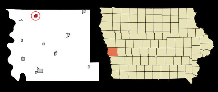
Map of Pisgah, IA 51564, USA
History
Pisgah was laid out in 1899. The town's name is a biblical one chosen by members of The Church of Jesus Christ of Latter-day Saints (Mormons), who established a temporary settlement in central Iowa near a hill they christened Mount Pisgah. A post office called Pisgah has been in operation since 1902.
Geography
Pisgah is located at 41°49′58″N 95°55′35″W (41.832684, -95.926464).
According to the United States Census Bureau, the city has a total area of 1.01 square miles (2.62 km2), all of it land.
Pisgah is also home of "The Old Home Cafe" made famous by CW McCall in the Old Home Bread commercials and in songs like "Old Home Filler-up Keep on Truckin Cafe".
2010 census
As of the census of 2010, there were 251 people, 121 households, and 66 families residing in the city. The population density was 248.5 inhabitants per square mile (95.9/km2). There were 143 housing units at an average density of 141.6 per square mile (54.7/km2). The racial makeup of the city was 97.6% White, 0.8% Native American, and 1.6% from two or more races. Hispanic or Latino of any race were 3.2% of the population.
There were 121 households of which 21.5% had children under the age of 18 living with them, 37.2% were married couples living together, 14.0% had a female householder with no husband present, 3.3% had a male householder with no wife present, and 45.5% were non-families. 43.8% of all households were made up of individuals and 24% had someone living alone who was 65 years of age or older. The average household size was 2.07 and the average family size was 2.83.
The median age in the city was 48.2 years. 23.1% of residents were under the age of 18; 5.3% were between the ages of 18 and 24; 16.8% were from 25 to 44; 30% were from 45 to 64; and 25.1% were 65 years of age or older. The gender makeup of the city was 46.2% male and 53.8% female.
2000 census
As of the census of 2000, there were 316 people, 143 households, and 84 families residing in the city. The population density was 314.4 people per square mile (120.8/km²). There were 147 housing units at an average density of 146.2 per square mile (56.2/km²). The racial makeup of the city was 99.05% White, 0.32% Native American, 0.32% Asian, and 0.32% from two or more races. Hispanic or Latino of any race were 0.63% of the population.
There were 143 households out of which 24.5% had children under the age of 18 living with them, 51.0% were married couples living together, 7.0% had a female householder with no husband present, and 40.6% were non-families. 36.4% of all households were made up of individuals and 25.2% had someone living alone who was 65 years of age or older. The average household size was 2.21 and the average family size was 2.89.
26.6% of the people are under the age of 18, 1.9% from 18 to 24, 21.2% from 25 to 44, 21.2% from 45 to 64, and 29.1% who were 65 years of age or older. The median age was 45 years. For every 100 females there were 83.7 males. For every 100 females age 18 and over, there were 88.6 males.
The median income for a household in the city was $26,125, and the median income for a family was $37,292. Males had a median income of $27,250 versus $17,500 for females. The per capita income for the city was $13,837. About 10.8% of families and 15.5% of the population were below the poverty line, including 16.4% of those under age 18 and 18.0% of those age 65 or over.