
- left East Branch - elevation 1,102 ft (336 m) Length 86 km Basin area 686.3 km² Country United States of America | - right North Branch - elevation 685 ft (209 m) Basin area 686.3 km² Mouth Tippy Dam Pond | |
 | ||
- location Wexford County, Michigan, United States - location Manistee County, Michigan, United States Cities Wellston, Tustin, Hoxeyville | ||
The Pine River, formerly known as the South Branch Manistee River, is a 53.6-mile-long (86.3 km) tributary of the Manistee River in the U.S. state of Michigan. It forms at the confluence of the North Branch and East Branch of the Pine River in northwest Osceola County, flows southwest, then west and north through the northeast corner of Lake County and back into southwest Wexford County, emptying into the Tippy Dam Pond on the Manistee River in Manistee County. The Pine River watershed drains an area of 265 square miles (690 km2).
Map of Pine River, Norman Township, MI, USA
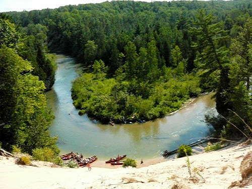
The river flows through a section of the Huron-Manistee National Forest, with multiple campgrounds, scenic overlooks and launch sites for personal, non-motorized watercraft. During the summer and fall seasons, canoe and kayak liveries are active with tourists taking trips on the Pine. This spring-fed river is constantly chilled and crystal clear, all year around. Much of Michigan's native wildlife can be spotted along the banks of the Pine, including Black Bears, White-Tail Deer, and Bald Eagles.
The Pine River was designated a National Scenic River in 1992.