
Country Philippines Founded 1908 Time zone PST (UTC+8) Local time Monday 9:26 AM Dialling code 43 | Region MIMAROPA (Region IV-B) Barangays Area 282.3 km² Province Oriental Mindoro | |
 | ||
District 2nd District of Oriental Mindoro Weather 27°C, Wind N at 6 km/h, 73% Humidity Points of interest Mega Pinoy Beach Resort, Bulaklak Beach Resort, Feliz Del Mar Beach Park | ||
Pinamalayan is a first class municipality in the province of Oriental Mindoro, Philippines. The name Pinamalayan comes from the word "ipinamalay", meaning "made aware or made known". According to the 2010 census, it has a population of 81,666 people.
Contents
- Map of Pinamalayan Oriental Mindoro Philippines
- The majestic hidden paradise walang langit falls in gloria pinamalayan oriental mindoro
- Geography
- Barangays
- Demographics
- History
- Legend of towns origin
- Spanish period
- American period
- Japanese period
- Typhoon Melor
- Economy
- Heritage
- San Agustin Ancestral House
- Schools
- References
Map of Pinamalayan, Oriental Mindoro, Philippines
The majestic hidden paradise walang langit falls in gloria pinamalayan oriental mindoro
Geography
The town of Ipinamalay (now Pinamalayan) is close to the shore on the river of the same name about 2-3/4 miles- south-westward of Bugot Point. The Pinamalayan River whose source originates from the mountains north of the town empties at the mouth of the old Lumang-Bayan River. Stretching from Mount Dumali in the north-eastern part of the island high and prominent, the coastal trends southward with a succession of sweeping curves towards Pinamalayan Bay to Duyagan Point.
The town is bounded on the north by Babahurin Hill and extends towards the north-west which meets the town of Pola. Towards the south and north, the town lies on an extensive plain and is low and flat towards the south direction to Balete and up to the boundary of Bongabon. About 90% of its area is located on its level plain which extends into the interior. It is intersected by three rivers, namely; the Lumangbayan, the Balete and the Pula Rivers which are short and never navigable. The town is exposed to the north-east monsoon, but with the mountain facing north, it is safe from that direction.
Barangays
Pinamalayan is politically subdivided into 37 Barangays.
Demographics
The town's population is mostly Mangyan and Tagalog.
History
The town of Pinamalayan is one of the oldest in the province of Oriental Mindoro. Its territory once went as far as the old settlements of Sumagui and Anilao which are now part of the towns Bansud and Bongabong respectively. The Town of Pinamalayan was also a former part of Pola until it got its permanent township status in the early years of American Colonization while Gloria was separated from Pinamalyan in 1964.
Legend of town's origin
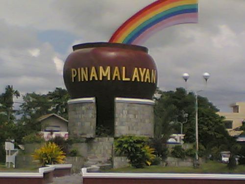
The town of Pinamalayan is close to the shore at the mouth of the river of the same name. The town’s name was said to be taken from the word “Ipinamalay na” which means to make aware or to show the way or it has been made known to us. According to an old story, the early settlers of this town came from Marinduque. While they were on their way to Mindoro in their big bancas (boats), they encountered turbulent weather and lost their way. They prayed to the God Almighty for deliverance and guidance, whereupon, the weather cleared and a rainbow appeared on the horizon, and guided them towards safety and to a place where they discovered abundant resources and endless promises. The crew shouted “ipinamalay na” (it was made known).
They followed the direction of the rainbow believing that at its en lies a pot of gold and good fortune. They finally landed at what is now Barangay Lumambayan and established the first settlement which they named Pinamalayan. They found good fortune in the new land which brought them prosperity because of the good soil and abundant resources.
Some other sources attribute the name Pinamalayan simply to the fact that the area was once a vast area planted to rice, hence the name “pinagpalayan” or “Pinamalayan”. Since then the place grew and became a town. However, during the entire 18th century, Pinamalayan was one of the coastal areas frequently attacked by Moro Pirates. People were decimated and many field to the interior for safety. In spite of all these, the town site remained in that place until 1916 when it was transferred by the Americans to its present site.
Spanish period
The history of the town has its ancient beginning antedating far back with the advent of the Marinduque settlers in the early part of the 18th century who landed on the shores of the old settlement at Lumang-bayan. The first village was implanted there by the newcomers pushing back the pagans into the interior. In the course of time and subjected by the ravages of Moro piracy, the natives had to fight back the buccaneers as well as the tulisanes at the end of the 19th century. The old Lumang-bayan was the town up to its transfer to the present site on or about 1914. The Recollect Order first established a part of the second ecclesiastic district of Naujan and extend as far as Bongabon, assigning St. Agustine as its titular (Patron Saint).
The pattern of this town’s territorial expansion dated back during the Spanish time when the villagers of Pinamalayan, Pola, Sumagui, Anilao and Bongabon belonged to one ministry district. That pattern was closely adhered to in the later part of the Spanish regime from 1888-1890. It was organized as a permanent settlement with Juan Morente, Sr. as gobernadorcillo and succeeded by his son, Juan Morente, Jr., as Captain (Mayor) in 1890-1894. When the revolution broke out against Spain, Pinamalayan took up arms and underwent some government changes under the provisional Malolos government headed by Juan Medina in 1898. When the Spaniards surrendered, Morente Jr. became governor of the province of Mindoro while Cornelio Nable was appointed as the municipal president.
American period
In the Filipino-American War, the American forces took possession of the town, placed it under a military regime from 1901 to 1902; appointed Cornelio Nable as its first President under the new civil government. Reorganized on April 28, 1904 under Act No. 1135 of the Philippine Commission, the municipalities of Bongabon and Pola were annexed to Pinamalayan as barrios. In the following year, on January 4, 1905, under Act No. 1280, the municipality of Pola was annexed to Pinamalayan as a barrio. In 1914, Pinamalayan was organized as a regular municipality. Since then, a new town site has been proposed, selected and surveyed for expansion. This new town site was planned by Governor Juan Morente, Jr. and Mr. Thomas I. Weeks. The American planners made sure that this new town will be laid out properly according to a planning system of wide symmetrical vertical and horizontal roads with proper drainage facilities. A big plaza was further constructed in front of the municipal building. Pinamalayan still stands as a model in town planning to all the municipalities in Oriental Mindoro.
In 1914 to 1916, during these years under review, the national high way to Pinamalayan has also been proposed and completed in 1931.
In January 1912, Pola was separated from Pinamalayan as township and in 1920, Bongabon was separated from Pinamalayan as a municipal district under Act No. 2824 of March 15, 1919. Agriculture and business developments gradually increased with opening of roads. More people immigrated since then; this position of publics land has hastened; homesteading increased and greater areas of uncultivated lands were turned to production.
Japanese period
On or about January 20, 1942, the Japanese Army from Calapan occupied the town and appointed Carlos Aguilocho and M. Medina as occupation Mayors. On or about January 15, 1945, the American Army from San Jose landed at Pinamalayan and liberated it from the enemy. Substantial progress has been made in the rehabilitation of the town since 1946. Municipal roads were repaired and extended, three big bridges were constructed (Balete, Nabuslot, and Lumambayan), a water system and a new market were constructed, a puericulture center and the beautification of the town plaza were undertaken. In 1948, Quinabigan was declared a national sub-port. The town is composed of six big barrios, namely; Lumang-bayan, Quinabigan, Nabuslot, Panggulayan, Maligaya, and Balete.
Typhoon Melor
On December 15, 2015, Pinamalayan is hit by Typhoon Nona (Melor), which made its fifth landfall. The town is badly damaged by the typhoon, with 15,000 homes devastated, about 83% of the 18,000 houses destroyed in Oriental Mindoro, and 24,000 families evacuated.
Economy
Pinamalayan is one of the ranking producers of coconuts in the Philippines. Its fertile plains are also devoted to yearly rice production making it a source of supply for Marinduque, Tablas, and neighboring localities. The municipality is one of the premier producers of bananas, a variety of forest products are gathered; a diversification of crops, vegetables and fruit trees are being accomplished.
It accounts for a variety of fish products from the sea; some fish ponds are now being developed; ranked second to none in the manufacture of wooden shoes, a distributing center of retail and wholesale trade for Sibale and Bongabon, it has a busy market in the poblacion and a barrio market at Nabuslot. It is not only a coconut region, but it is also a retail and wholesale trade center. It stands with 5 drug stores, 74 dry goods stores, 2 jewelry and repair shops, 4 bars, and refreshment parlors, 4 barber shops, 3 furniture houses, 5 restaurants, 2 gasoline stations, 4 tailor shops, 4 bakeries, 4 photographers, 20 Chinese stores, 5 lumber and hardware dealers, 5 cockpits, 2 contractors, a PRISCO store, 16 copra dealers, 3 wooden shoe factories, 1 theatre, 36 public market stall holders, 17 fishermen, and 46 tuba dealers.
Pinamalayan’s semi-circular waterfront affords excellent anchorage for vessels of inter-island type and visited weekly by steamers direct from Manila via Marinduque. It also affords an anchorage for ocean-going vessels in the sub-port of Quinabigan where copra is shipped every three months. It stands mid-way in the national high way to Bongabon and to Calapan. The Borbon and Halcon buses make this town a terminal and transport system. In the field of communication service, it has postal and telegraphic services, serving a wide area of 21,000 souls. It boasts also of its 2 light houses, one at Punta Dumali and other in town proper.
Pinamalayan in its bid to become the premier financial destination in the Southern part of Oriental Mindoro saw the emergence of national business establishing their branch on this municipality. Recently, Jollibee established its branch in Barangay Marfrancisco on the area more popularly called Triangle near Abada College and Pinamalayan Maritime Foundation Technological College, the first and only maritime school in Pinamalayan.There is also a plan to establish SM Savemore in the town's Poblacion proper near the Municipal Hall. Some of the more popular franchises such as Potato Corner and Siomai House are also located in this town.
ATM service is also available in this town with the emergence of major banks such as Metrobank, Landbank of the Philippines and Philippine National Bank among others.
There are two branches of Mercury Drug on this town complementing the medical requirements of the town's constituents.
Heritage
Pinamalayan has a number of ancestral houses which are now mostly used for business purposes.
San Agustin Ancestral House
Located along Burgos St. corner Mabini St., San Agustin Ancestral House was built in 1922. Wide plank hardwood flooring is maintained in the second floor which now houses an internet café.
Schools
Tertiary
Secondary
Elementary