
Population 379 (1 Jan 2008) Local time Friday 6:44 PM | Time zone CET (UTC+1) Municipality De Marne | |
 | ||
Weather 16°C, Wind SW at 23 km/h, 67% Humidity | ||
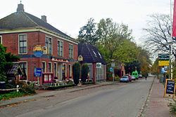
Pieterburen is a village in the northeastern Netherlands, located in the municipality of De Marne, Groningen.
Map of Pieterburen, Netherlands
Pieterburen is situated on the ‘Hogeland’ (high land) of northeastern Groningen. It is an area with brick Gothic churches, stately farms, and endless views over the land, all the way to the Wadden Sea.
Pieterburen is known for its Seal Rehabilitation and Research Centre, the vicarage garden Domiestoen, the old mill De Vier Winden (The Four Winds), and for mudflat hiking in the Wadden Sea. Its medieval castle, Huis ten Dyke, was torn down a century ago.
Pieterburen is the start of the Pieterpad, a long-distance hiking trail to Sint Pieter in the extreme south of the Netherlands
References
Pieterburen Wikipedia(Text) CC BY-SA