
Country United States FIPS code 31-39100 Elevation 482 m Population 1,741 (2013) Area code 402 | Time zone Central (CST) (UTC-6) GNIS feature ID 0832093 Zip code 68767 Local time Friday 9:00 AM | |
 | ||
Weather 5°C, Wind N at 13 km/h, 89% Humidity Area 241 ha (236 ha Land / 5 ha Water) | ||
Pierce is a city and county seat of Pierce County, Nebraska, United States. The population was 1,767 at the 2010 census.
Contents
- Map of Pierce NE 68767 USA
- History
- Geography
- Demographics
- 2010 census
- 2000 census
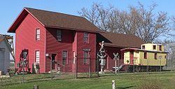
- Points of interest
- References
Map of Pierce, NE 68767, USA
History
Pierce was platted in 1871, and a courthouse was erected that same year. Like Pierce County, the name honors President Franklin Pierce.
The city became a point of international interest in 2013 due to the Lambrecht auto auction, at which nearly 500 classic cars were put up for sale.
Geography
Pierce is located at 42°11′58″N 97°31′46″W (42.199477, -97.529321). According to the United States Census Bureau, the city has a total area of 0.93 square miles (2.41 km2), of which, 0.91 square miles (2.36 km2) is land and 0.02 square miles (0.05 km2) is water.
Demographics
It is part of the Norfolk, Nebraska Micropolitan Statistical Area.
2010 census
As of the census of 2010, there were 1,767 people, 706 households, and 479 families residing in the city. The population density was 1,941.8 inhabitants per square mile (749.7/km2). There were 747 housing units at an average density of 820.9 per square mile (317.0/km2). The racial makeup of the city was 98.9% White, 0.3% Native American, 0.2% Asian, 0.2% from other races, and 0.5% from two or more races. Hispanic or Latino of any race were 1.2% of the population.
There were 706 households of which 34.0% had children under the age of 18 living with them, 53.8% were married couples living together, 8.8% had a female householder with no husband present, 5.2% had a male householder with no wife present, and 32.2% were non-families. 29.3% of all households were made up of individuals and 16.6% had someone living alone who was 65 years of age or older. The average household size was 2.41 and the average family size was 2.97.
The median age in the city was 40.2 years. 26% of residents were under the age of 18; 6.6% were between the ages of 18 and 24; 23.9% were from 25 to 44; 24.6% were from 45 to 64; and 18.8% were 65 years of age or older. The gender makeup of the city was 49.8% male and 50.2% female.
2000 census
As of the census of 2000, there were 1,774 people, 682 households, and 465 families residing in the city. The population density was 2,023.2 people per square mile (778.3/km2). There were 736 housing units at an average density of 839.4 per square mile (322.9/km2). The racial makeup of the city was 99.10% White, 0.23% Native American, 0.11% Asian, 0.06% Pacific Islander, 0.23% from other races, and 0.28% from two or more races. Hispanic or Latino of any race were 0.73% of the population.
There were 682 households out of which 35.0% had children under the age of 18 living with them, 58.1% were married couples living together, 7.5% had a female householder with no husband present, and 31.7% were non-families. 29.5% of all households were made up of individuals and 17.4% had someone living alone who was 65 years of age or older. The average household size was 2.50 and the average family size was 3.12.
In the city, the population was spread out with 28.2% under the age of 18, 8.3% from 18 to 24, 25.4% from 25 to 44, 18.1% from 45 to 64, and 20.1% who were 65 years of age or older. The median age was 38 years. For every 100 females there were 92.2 males. For every 100 females age 18 and over, there were 87.6 males.
As of 2000 the median income for a household in the city was $35,288, and the median income for a family was $43,068. Males had a median income of $27,436 versus $21,034 for females. The per capita income for the city was $15,702. About 6.7% of families and 8.6% of the population were below the poverty line, including 6.9% of those under age 18 and 14.4% of those age 65 or over.