
Elevation 2,914 m | Prominence 160 m Parent range Pyrenees | |
 | ||
Similar Roca Entravessada, Coma Pedrosa, Pic de Sanfonts, Pica d'Estats, Pic de l'Estanyó | ||
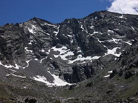
Pic de Médécourbe (Catalan: Pic de Medacorba) is a mountain in Europe that sits on the western tripoint boundary of Andorra, France and Spain. It is 2,914 metres (9,560 ft) tall. It overlooks Étang de Soulcem, a large artificial lake used for hydroelectricity, and the Vicdessos valley.
Map of Pic de M%C3%A9d%C3%A9courbe
There is also an eastern tripoint of Andorra, France, and Spain approximately 6 km south of Pas de la Casa.
References
Pic de Médécourbe Wikipedia(Text) CC BY-SA