
Airport type Public/Military Elevation AMSL 24 m / 79 ft 3,051 10,010 Elevation 24 m Phone +84 56 3822 953 | Location Phù Cát District 15/33 3,051 Code UIH Province Binh Dinh Province Serves Qui Nhơn | |
 | ||
Operator Middle Airport Authority Similar Ga Diêu Trì, HTX Vận Tải Cơ Giới Huyện Ph, Chợ Gò Bồi, Phòng Vé Vietnam Airline | ||
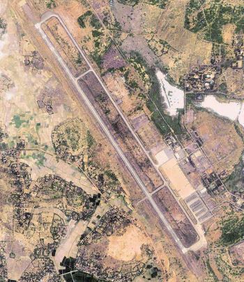
Phu Cat Airport (IATA: UIH, ICAO: VVPC) (Vietnamese: Sân bay Phù Cát) is the airport serving Qui Nhơn, Vietnam. It is in Phù Cát District between the towns of Ngo May and Đập Đá, around 30 kilometres (19 mi) northwest of Qui Nhơn within Bình Định Province along the South Central Coast of Vietnam.
As well as being a commercial airport, Phu Cat is also used by the Vietnamese Air Force (Khong Quan Nhan Dan Viet Nam).
History
Phù Cát Airport was built in 1966 during the Vietnam War by the United States Air Force (USAF). During the war, it was a major air base for the South Vietnamese Air Force and USAF. After 1975, it was used as a military airfield for the Vietnamese Air Force (Khong Quan Nhan Dan Viet Nam), and developed into a regional civil airport.
References
Phu Cat Airport Wikipedia(Text) CC BY-SA