
Country United States County Worcester Incorporated 1786 Elevation 355 m Zip code 01331 Local time Thursday 7:38 AM | Settled 1751 Time zone Eastern (UTC-5) Founded 1786 Population 1,682 (2010) | |
 | ||
Weather -2°C, Wind NW at 8 km/h, 64% Humidity Area 63.71 km² (62.94 km² Land / 104 ha Water) | ||
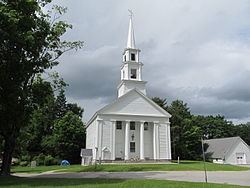
Phillipston is a town in Worcester County, Massachusetts, United States. The population was 1,682 at the 2010 census.
Contents
Map of Phillipston, MA 01331, USA
History
Phillipston was first settled in 1751, and incorporated as the town of Gerry in 1786, after separating from Templeton. It was named after Elbridge Gerry. The town's name was changed from Gerry to Phillipston in 1814, after lieutenant governor William Phillips, Jr.
Geography
According to the United States Census Bureau, the town has a total area of 24.6 square miles (64 km2), of which 24.3 square miles (63 km2) is land and 0.4 square miles (1.0 km2), or 1.54%, is water.
Phillipston is bordered by Petersham to the southwest, Athol to the northwest, Royalston to the north, Templeton to the east, Hubbardston to the southeast, and a small portion of Barre to the south.
Demographics
As of the census of 2000, there were 1,621 people, 580 households, and 443 families residing in the town. The population density was 66.8 people per square mile (25.8/km²). There were 739 housing units at an average density of 30.5 per square mile (11.8/km²). The racial makeup of the town was 97.72% White, 0.37% African American, 0.12% Native American, 0.37% Asian, and 1.42% from two or more races. Hispanic or Latino of any race were 0.43% of the population.
There were 580 households of which 39.5% had children under the age of 18 living with them, 63.8% were married couples living together, 8.1% had a female householder with no husband present, and 23.6% were non-families. 17.6% of all households were made up of individuals and 5.0% had someone living alone who was 65 years of age or older. The average household size was 2.79 and the average family size was 3.19.
In the town, the population was spread out with 29.2% under the age of 18, 5.2% from 18 to 24, 33.3% from 25 to 44, 24.7% from 45 to 64, and 7.5% who were 65 years of age or older. The median age was 37 years. For every 100 females there were 101.1 males. For every 100 females age 18 and over, there were 106.7 males.
The median income for a household in the town was $46,845, and the median income for a family was $52,011. Males had a median income of $39,231 versus $25,625 for females. The per capita income for the town was $18,706. About 3.8% of families and 5.8% of the population were below the poverty line, including 8.5% of those under age 18 and 4.0% of those age 65 or over.
Library
"The Phillips Free Public Library of Phillipston was founded in 1860." In fiscal year 2008, the town of Phillipston spent 1.08% ($31,203) of its budget on its public library—some $17 per person.