
Country United States GNIS feature ID 0766215 Area 146.2 km² Population 795 (2010) | FIPS code 29-57224 Elevation 294 m Local time Wednesday 10:08 AM Number of airports 1 | |
 | ||
Weather 6°C, Wind E at 26 km/h, 100% Humidity | ||
Pettis Township is one of ten townships in Adair County, Missouri, United States. As of the 2010 census, its population was 795. It is named for former US Congressman Spencer Pettis, who represented Missouri from 1829 to 1831 until being killed in a duel.
Contents
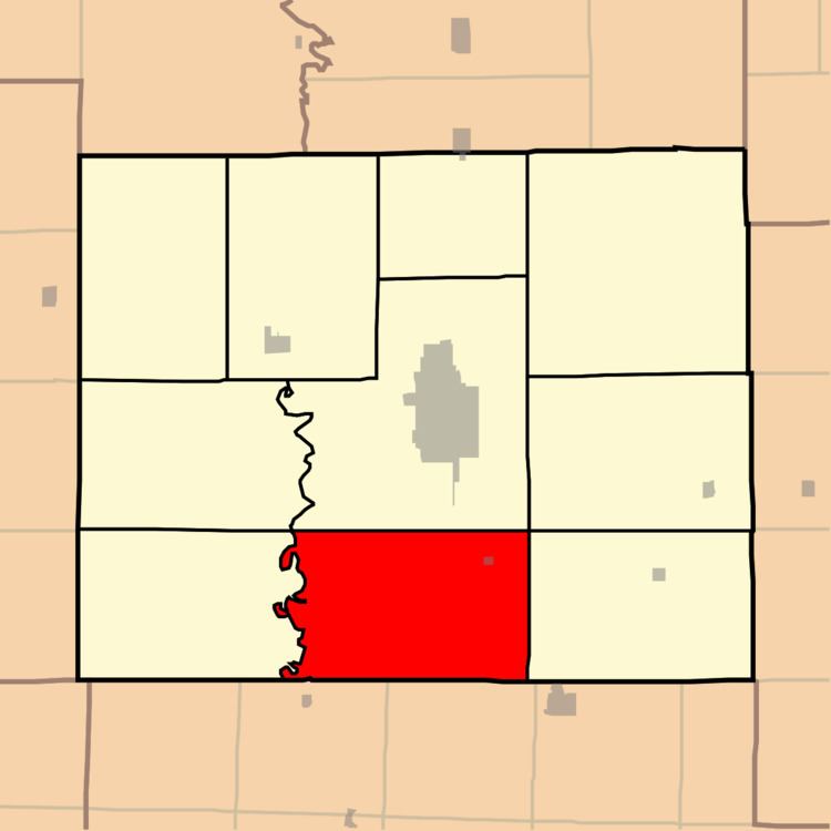
Map of Pettis Township, MO, USA
Geography
Pettis Township covers an area of 56.4 square miles (146.2 km2) and contains one incorporated settlement, Millard. It contains seven cemeteries: Bragg, Canaday, Indian Hill, Indian Hill (historical), Shaver, Shoemaker and Stukey.
The streams of Elm Creek, Goose Creek, Hog Creek, Indian Creek, Sugar Creek and Turkey Run run through this township.
Transportation
Pettis Township contains one airport, Kirksville Regional Airport.
U.S. Highway 63 passes through the township.
References
Pettis Township, Adair County, Missouri Wikipedia(Text) CC BY-SA