
Time zone EET (UTC+2) Elevation 13 m Local time Wednesday 2:53 PM | Municipality Petra Postal code 811 09 Area 72,479 km² Area code 22530 | |
 | ||
Weather 19°C, Wind NE at 11 km/h, 45% Humidity | ||
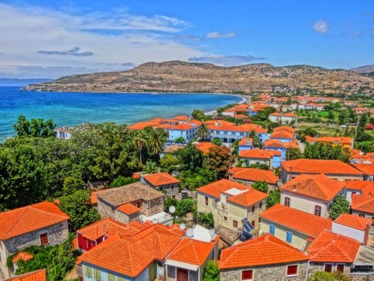
Petra (Greek: Πέτρα meaning rock) is a former municipality on the island of Lesbos, North Aegean, Greece. Since the 2011 local government reform it is part of the municipality Lesbos, of which it is a municipal unit. It is located at the northwest of Lesbos and comprises the villages Petra, Skoutaros, Stypsi, Lafionas, Ypsilometopo and the settlements Petri and Anaxos.
Contents
Map of Petra 811 09, Greece
Geography
The region combines exceptional natural beauties: olive groves and forests with pines, oak-trees, cypress-trees as well as fruit-bearing trees, traditional stone built mountain villages with running waters and rich vegetation, but also seaside modern summer holiday settlements with sandy beaches and crystal waters. Petra Lesvos is beginning to sprawl behind its broad, sandy beach and seafront square with a core of old stone houses, many with Levantine-style balconies overhanging the streets. Petra takes its name from the giant monolith located some distance inland and capped by the eighteenth-century church of Panagia Glykofiloussa, reached via 114 rock-hewn steps on the northeast side. The town of Mithymna is approx. 6 km to the north. The municipality has a land area of 72.479 km² and a population of 3,358 at the 2011 census. Its largest towns are Pétra, the municipal seat (pop. 1,208), Stýpsi (855), and Skoutáros (1,037).