
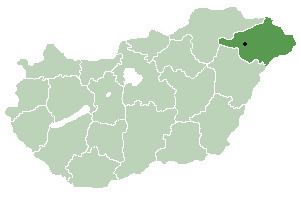
Time zone CET (UTC+1) Area 24.2 km² Local time Tuesday 8:04 AM | County Szabolcs-Szatmár-Bereg Postal code 4542 Population 1,732 (2015) Area code 45 | |
 | ||
Weather 2°C, Wind S at 5 km/h, 82% Humidity | ||
Petneháza is a village in Szabolcs-Szatmár-Bereg county, in the Northern Great Plain region of eastern Hungary.
Contents
Map of Petneh%C3%A1za, Hungary
Geography
It covers an area of 24.2 km2 (9 sq mi) and has a population of 1732 people (2015).
References
Petneháza Wikipedia(Text) CC BY-SA