
Local time Monday 3:42 PM | Area 16.05 km² | |
 | ||
Canton Saint-Mamet-la-Salvetat Weather 17°C, Wind SE at 27 km/h, 43% Humidity | ||
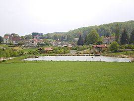
Pers is a former commune in the Cantal department in south-central France. On 1 January 2016, it was merged into the new commune Le Rouget-Pers.
Map of 15290 Pers, France
It is on the edge of the Chataignerie and near the Segala. It is also adjacent to the lake of St Etienne Cantales, a large body of water formed by the damming of the Cere river for hydro electric purposes.
The village also has a very good go-cart track, and regularly hosts championship races.
As well as the church and the town hall, there are two bars, and a camping site. Gites may also be rented from the farm. There are no shops.
References
Pers, Cantal Wikipedia(Text) CC BY-SA