
Existed: 1955 – present Length 89.5 km Province Manitoba | West end: PTH 1 (TCH) / Route 85 Constructed 1955 | |
 | ||
East end: PTH 1 (TCH) / Route 135 Major
junctions: PTH 59 / Route 20
PTH 75 / Route 42
PTH 2
PTH 3 / Route 155 Major
junctions: PTH 190
PTH 6
PTH 7 / Route 90
PTH 8 / Route 180
PTH 9 / Route 52
PTH 59 / Route 20
PTH 15 / Route 115 | ||
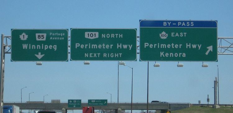
Provincial Trunk Highways (PTH) 100 and 101 (locally known as the Perimeter Highway) form a beltway around the Canadian city of Winnipeg, Manitoba. The Perimeter is approximately 90 km (56 mi) long. It is an alternate route around Winnipeg for through traffic, as there are no freeways through the city.
Contents
- Map of Perimeter Hwy Manitoba Canada
- History
- Exit list
- Inner city beltway the second half of the Perimeter plan
- References
Map of Perimeter Hwy, Manitoba, Canada
History
The highway was originally built in 1955, following the cancellation of a freeway system to accommodate traffic around Winnipeg to avoid the city centre rush hour traffic. The northeast section was left unbuilt at the time, as PTH 59 had received significant upgrades, making the need for a northeast section less pressing. PTH 59 continued to serve as the de facto northeast leg of the Perimeter until the mid-1990s, when the remaining segments of the highway were completed. The highway now encircles Winnipeg.
Most of the Perimeter is a four-lane divided expressway, with interchanges and at-grade intersections. The only section that remains two-lane is in the vicinity of the PTH 59N interchange. In September 2015 however, construction began on upgrading the current at-grade intersection at PTH 59 with a modified Cloverleaf interchange. Once complete, the remainder of the two-lane Perimeter will be upgraded to divided highway, thus making the entire ring road divided highway. Construction is expected to be complete by 2018.
The southern segment of the Perimeter Highway is part of the Trans-Canada Highway as a Winnipeg bypass, and designated as Highway 100. The northern segment is a provincial highway designated as PTH 101.
The Perimeter Highway bridge across the Red River and roadway at Pembina Highway was constructed in 1958. The job was tendered to Peter Leitch Construction Ltd. at a cost of $188,670. In December 1957, Dominion Bridge was awarded the contract ($80,157) to supply the structural steel for the overpass.
Exit list
Exit numbering begins at Fermor Avenue and increases clockwise.
Inner city beltway, the second half of the Perimeter plan
This roadway is what was to be part of a two ring road system, with the outer Perimeter Highway, and an inner ring. The inner ring was initially tabled in the 1960s and was slow to progress.
The inner ring, also sometimes referred to as the inner city beltway, was to be (Route 17) the Chief Peguis Trail to the north, heading west to Route 96 (William R. Clement Pkwy), circling to Route 165 (Bishop Grandin Blvd), and from there to a point near Northern Blower on Route 37 (Regent Ave). Several years ago a group working with a councillor, worked to stop the loop from going into the Transcona area, and had the roadway's land designated a natural prairie grass park. From this point on Regent, the road was supposed to loop north back to Route 17 (Chief Peguis Tr). The current plan has had to move the eastern portion to Plessis Road. Plessis Road is not as suited to the required connection and space for intersections, but is the only remaining viable option.
While construction of the east–west Bishop Grandin portion was done years ago, the northern portions have remained unlinked, with only the short portion between Route 52 (Main Street) and Lagimodière. This has provided an effective link over the Red River, but the short span of road leaves much of the north part of the city with difficult navigation choices on an east–west basis, often pushing major cross town traffic to use residential roads and regional arteries like Inkster, MacIvor and Springfield Roads.
The city of Winnipeg completed the extension of Route 17 (Chief Peguis Tr) to Lagimodière Blvd in December 2011. This brings the inner ring road one step further to completion.
The absence of a link between the intersection of Route 52 (Main St) and Route 17 (Chief Peguis Tr) toward Route 90 (Brookside Blvd) makes east-west travel difficult, and is an important link for the north part of town to significant areas like the Airport and Red River Community College, as well as the future CentrePort (an inland port).
The land for these links is owned by the city and simply awaits the laying of roadway. These type of major traffic arteries are designed to carry crosstown traffic efficiently with fewer environmentally damaging starts and stops. Further these roadways are designed to move traffic away from direct contact with residential streets.