
Status Mostly infilled Construction began 1839 Date completed 1840 | Connects to Dudley Canal Date closed 1950 | |
 | ||
Maximum height above sea level 473 ft (144 m)
(Wolverhampton Level) | ||
The Pensnett Canal, also called Lord Ward's Canal was a private 1.25 miles (2 km) long canal near Brierley Hill, West Midlands, England. The engineer was Mathew Frost. It has now almost entirely been lost by overbuilding.
Map of Pensnett Canal, Dudley, UK
It ran from Parkhead Basin at the southern portal of the Dudley Canal to the Wallows Wharf to serve the Earl of Dudley's coalfields (Old Park and Wallows Collieries) and the northern part of his (now demolished) Round Oak Steelworks, where a short railway ran to the Staffordshire and Worcestershire Canal. The Dudley No. 1 Canal ran close to the southern part of that works.
It was also known as Lord Ward's Canal although there is an identically named branch from the northern portal of the Dudley Tunnel. Baron Ward was another title of the Earl of Dudley.
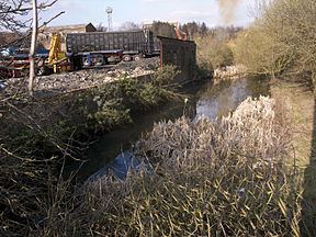
The canal is completely unnavigable, having been partly infilled and in many places built upon by industrial premises. The remaining canal was reported by the local council to be contaminated. A short length, now called Pensnett Basin, runs between Parkhead Junction and an arch of the Parkhead Viaduct, where the arch has been closed off. There is no further access to the former canal although a public footpath follows a short distance over the course between factories. The course of the canal can also be observed from a number of road bridges.