
Country United States ZIP code 28765 Elevation 750 m | Time zone Eastern (EST) (UTC-5) Area code(s) 828 Local time Sunday 4:13 AM | |
 | ||
Weather 13°C, Wind S at 8 km/h, 84% Humidity | ||
Penland is an unincorporated community in Mitchell County, North Carolina, United States. Penland is 2.9 miles (4.7 km) west-northwest of Spruce Pine. Approximately 200 year-round residents live in the community, the center of which is the Penland Road bridge crossing the North Toe River and CSX railroad line.
Map of Penland, NC 28777, USA
The community is located on the northern edge of western North Carolina's Black Mountains and is bisected by the North Toe River, a tributary of the Cane and Nolichucky rivers.
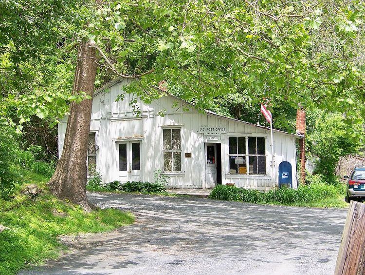
The Penland Post Office and General Store with ZIP code 28765, is listed on the National Register of Historic Places due to its significance as the longest continuously operating post office in the area. Also listed in the National Register of Historic Places are the Penland School Historic District and the Henry Willis House.
The community is named for Robert Penland, a wealthy local businessman who in the 1850s operated an inn for travelers. Penland School of Crafts, established in the early 1920s, is the largest and oldest professional crafts school in the United States. The school offers courses in all of the major craft media and many fine arts fields, bringing thousands of students and prominent instructors together every year. Nine of North Carolina's seventeen Living Treasures live within a five mile radius of Penland.