
Country United States County Hillsborough Time zone Eastern (UTC-5) Elevation 47 m Population 12,897 (2010) | Incorporated 1746 Area code(s) 603 Zip code 03076 Local time Saturday 7:40 PM | |
 | ||
Weather 1°C, Wind W at 2 km/h, 97% Humidity | ||
Pig goes hog wild at pelham new hampshire voting location
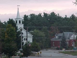
Pelham /ˈpɛləm/ is a town in Hillsborough County, New Hampshire, United States. The population was 12,897 at the 2010 census.
Contents
- Pig goes hog wild at pelham new hampshire voting location
- Map of Pelham NH USA
- History
- Geography
- Demographics
- School system
- Transportation
- Muldoon Park
- Notable people
- References
Map of Pelham, NH, USA
History
Pelham was split from Old Dunstable in 1741, when the border between Massachusetts and New Hampshire was settled. It was incorporated in 1746. The town is named after Thomas Pelham-Holles, 1st Duke of Newcastle.
Geography
According to the United States Census Bureau, the town has a total area of 27.0 square miles (69.9 km2), of which 26.4 sq mi (68.4 km2) is land and 0.5 sq mi (1.3 km2) is water, comprising 1.93% of the town. The highest point in Pelham is Jeremy Hill, at 577 feet (176 m) above sea level. The town contains the southernmost point in the state of New Hampshire, at 42°41′49″N 71°17′40″W, a location known as the "Old Boundary Pine", named for a pine tree that marked the difference in definition of the northern boundary of Massachusetts. This point is 3 miles due north of Pawtucket Falls, and marks the point where the straight-line border to the west meets the 3 mile buffer defined by the Merrimack River.
In addition to being New Hampshire's southernmost town, Pelham is the easternmost town in Hillsborough County. Three New Hampshire towns and three Massachusetts towns border Pelham: Tyngsborough to the southwest, Dracut to the south and east, Methuen to the east, Salem to the northeast, Windham to the north, and Hudson to the west.
Demographics
The earliest census data shows the town of Pelham having a population of 543 residents in 1767.
As of the census of 2000, there were 10,914 people, 3,606 households, and 2,982 families residing in the town. The population density was 412.9 people per square mile (159.4/km²). There were 3,740 housing units at an average density of 141.5 per square mile (54.6/km²). The racial makeup of the town was:
Hispanic or Latino of any race were 0.96% of the population. (U.S. average: 12.5%)
In 2000, there were 3,606 households, with an average household size of 3.03 and an average family size of 3.33.
In 2000, the town's population had a median age of 36 years (U.S. average: 35.3).
For every 100 females there were 98.8 males. For every 100 females age 18 and over, there were 99.3 males.
The median income for a household in the town was $68,608. (U.S. average: $41,994). The median income for a family was $73,365. (U.S. average: $50,046). Males had a median income of $47,685 versus $33,375 for females. The per capita income for the town was $25,158. About 1.6% of families (U.S. average: 9.2%) and 3.0% of the population (U.S. average: 12.4%) were below the poverty line, including 3.1% of those under age 18 and 4.7% of those age 65 or over.
School system
Transportation
Pelham is crossed by three New Hampshire state routes:
The closest Interstate highway is Interstate 93, which is accessed 6 miles (10 km) northeast of the center of Pelham in neighboring Salem. Pelham appears on that highway's signs for Exit 2. The U.S. Route 3 freeway that runs through Nashua is 8 miles (13 km) west of the center of Pelham, and Interstate 495 in Massachusetts is 9 miles (14 km) south of Pelham, on the south side of Lowell.
Pelham has no air or rail transport within the town limits. The nearest commercial airport is Manchester–Boston Regional Airport along the border of Londonderry and Manchester. The nearest rail service is the Lowell Line of the MBTA Commuter Rail which can be accessed at the Charles A. Gallagher Transit Terminal in Lowell, Massachusetts. The nearest Amtrak stations are Boston's North Station or South Station.
Muldoon Park
The park is located northwest of the center of Pelham at 305 Mammoth Road (NH 128), just north of Nashua Road. The park's land area is surrounded by NH 128, two roads that branch off it, and a minor road which intersects NH 111A.
Muldoon Park offers many short walking trails, four variously sized baseball fields (ranging from t-ball to official), a soccer field, and a play area. Most of the trails lead to the park's two ponds, local roads and houses or to Beaver Brook, a small river. The town of Pelham completed an 18-hole disc golf course here, stretching over a quarter-mile, in September 2007.
The Pelham Parks and Recreation department has recently added two non-official sized baseball fields to the southwest corner of the park. Construction is complete on one field with the exception of dugouts, and the other field is still under construction, as of September 2013.
There is now an 18-hole disc golf course at this park. Many players from surrounding towns enjoy a round of disc golf set in the woods adjacent to the sport fields.