
Founded 1927 Distance to – Santo Domingo 335 km Area 1,275 km² Population 27,955 (2012) Number of airports 1 | Municipality since 1957 Municipal Districts 2 Elevation 10 m Local time Saturday 11:09 AM | |
 | ||
Weather 29°C, Wind SW at 13 km/h, 62% Humidity Neighborhoods Los Coquitos, Barrio Nicolás Féliz, Brisas del Mar, Barrio Campo de Aviación, Barrio Inés | ||
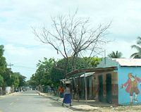
The Dominican city of Pedernales is the capital of the Pedernales Province, in the Dominican Republic. It is located in the southwest of the country, on the border, and has a crossing to the Haitian town of Anse-à-Pitres.
Contents
- Map of Pedernales 84000 Dominican Republic
- National Parks
- History
- Culture
- Touristic Places
- Climate
- References
Map of Pedernales 84000, Dominican Republic
National Parks
These two parks, along with Lake Enriquillo and adjoining zones of the Municipality Pedernales, form the first biosphere reserve in the country.
History
The official foundation of the colony of Pedernales was produced in the year 1927 during the Government of Horacio Vásquez, who appointed as Administrator to the well-known writer Sócrates Nolasco.
The colonists proceeded of Duvergé mostly. The first one was Mrs Epiphany Rocha, later other families from Barahona arrived, Oviedo and Villa Jaragua. In the year 1937 the highway was built to join with this locality and Oviedo, in whose works they participated 500 men divided into brigades of 10 each one.
By Resolution of the City Hall of Enriquillo in the 1938, Pedernales was raised to Municipal District.
The name of Pedernales stems from the denomination Flint that is a variety of very common quartz of yellowish color "that produces spark with the link". This stone is found in the river of Pedernales, that limit frontier in the south extreme between Haiti and Dominican Republic.
Culture
Touristic Places
Climate
Its location over a number of rain shadows through the highlands of Hispaniola from the northeasterly trade winds gives Pedernales a semi-arid climate (Köppen BSh). Rainfall is highest in September and October when tropical cyclones may strike the whole island, and temperatures are generally warmer during the day than in much of the tropics.