
Country United States FIPS code 26-63260 Elevation 240 m Zip code 48466 Local time Saturday 10:46 AM | Time zone Eastern (EST) (UTC-5) GNIS feature ID 0634544 Area 2.72 km² Population 615 (2013) Area code 810 | |
 | ||
Weather 2°C, Wind NE at 16 km/h, 97% Humidity | ||
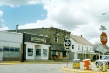
Peck is a village in Sanilac County of the U.S. state of Michigan. The population was 632 at the 2010 census. The village is in Elk Township.
Contents
Map of Peck, MI 48466, USA
Geography
According to the United States Census Bureau, the village has a total area of 1.05 square miles (2.72 km2), all land.
2010 census
As of the census of 2010, there were 632 people, 246 households, and 151 families residing in the village. The population density was 601.9 inhabitants per square mile (232.4/km2). There were 283 housing units at an average density of 269.5 per square mile (104.1/km2). The racial makeup of the village was 95.1% White, 0.6% African American, 2.2% Native American, 0.2% Asian, 0.5% from other races, and 1.4% from two or more races. Hispanic or Latino of any race were 4.9% of the population.
There were 246 households of which 33.3% had children under the age of 18 living with them, 46.3% were married couples living together, 12.2% had a female householder with no husband present, 2.8% had a male householder with no wife present, and 38.6% were non-families. 29.7% of all households were made up of individuals and 13% had someone living alone who was 65 years of age or older. The average household size was 2.54 and the average family size was 3.23.
The median age in the village was 37.1 years. 25.9% of residents were under the age of 18; 11.1% were between the ages of 18 and 24; 24.2% were from 25 to 44; 24.5% were from 45 to 64; and 14.2% were 65 years of age or older. The gender makeup of the village was 47.8% male and 52.2% female.
2000 census
As of the census of 2000, there were 599 people, 239 households, and 162 families residing in the village. The population density was 593.0 per square mile (229.0/km²). There were 253 housing units at an average density of 250.4 per square mile (96.7/km²). The racial makeup of the village was 96.83% White, 0.67% Native American, 0.33% Asian, and 2.17% from two or more races. Hispanic or Latino of any race were 1.17% of the population.
There were 239 households out of which 32.6% had children under the age of 18 living with them, 51.9% were married couples living together, 12.1% had a female householder with no husband present, and 32.2% were non-families. 28.9% of all households were made up of individuals and 13.0% had someone living alone who was 65 years of age or older. The average household size was 2.46 and the average family size was 3.04.
In the village, the population was spread out with 27.4% under the age of 18, 9.3% from 18 to 24, 27.4% from 25 to 44, 20.5% from 45 to 64, and 15.4% who were 65 years of age or older. The median age was 34 years. For every 100 females there were 92.6 males. For every 100 females age 18 and over, there were 91.6 males.
The median income for a household in the village was $29,063, and the median income for a family was $36,023. Males had a median income of $30,000 versus $20,804 for females. The per capita income for the village was $14,622. About 10.3% of families and 12.5% of the population were below the poverty line, including 15.0% of those under age 18 and 9.2% of those age 65 or over.