
Population 1,259 (2011 census) Local time Saturday 8:53 PM | Postcode(s) 4519 Postal code 4519 Parish Durundur Lane | |
 | ||
Weather 22°C, Wind SE at 8 km/h, 83% Humidity | ||
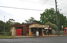
Peachester is a small town and locality in the Sunshine Coast Region, Queensland, Australia. In the 2011 census, Peachester had a population of 1,259 people.
Contents
Map of Peachester QLD 4519, Australia
Geography
Peachester is located on the eastern slopes of the Conondale Range in the Sunshine Coast hinterland.
History
Peachester was named when the town was surveyed in 1888 and it is thought that the name refers to peach trees which were growing at the river crossing. A public hall was built at the town in 1889, and was home to the Peachester school when it started in 1892.Early industries included dairying, timber felling for Grigor's sawmill and a case factory for fruit growers in the 1920s and post World War Two years.
Peachester Post Office opened by 1918 (a receiving office had been open from 1895) and closed in 1974.
Between the 1930s and 1950s, Peachester was known as the home of Inigo Jones, the long range weather forecaster.
At the 2006 census, Peachester had a population of 452.
Heritage listings
Peachester has a number of heritage-listed sites, including: