
Country United States County Worcester Incorporated 1765 Elevation 353 m Population 4,806 (2010) | Settled 1749 Time zone Eastern (UTC-5) Zip code 01612 | |
 | ||
Weather 4°C, Wind W at 18 km/h, 75% Humidity | ||
Paxton is a town in Worcester County, Massachusetts, United States. The population was 4,806 at the 2010 census.
Contents
- Map of Paxton MA 01612 USA
- History
- Geography
- Demographics
- Points of interest
- Education
- Library
- Utilities
- Notable people
- References
Map of Paxton, MA 01612, USA
History
Paxton was first settled in 1749 and was officially incorporated in 1765.
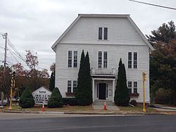
The district of Paxton was originally taken from the towns of Leicester and Rutland, in nearly equal parts, and was incorporated February 12, 1765. Charles Paxton, marshal of the Admiralty Court, offered a church bell to the town if it was named after him; no such gift was ever made. The inhabitants soon commenced their plan for building a meeting house, and on the first day of April 1765, the town voted to build it. It was raised on 18 June 1766, and this is the frame of the present meeting house.
In 1766, within two years of the incorporation of the town, the foundation of the present meeting house was laid, on what is now the common, near the flagstaff. The land was given by Seth Howe, from a piece of his pasture.
David Davis went to Boston with a pair of oxen and drew to Paxton the bell now in use, which was made by Paul Revere.
A small historic and now defunct amusement park called "Paxton Yard" operated here in the mid 20th century.
Mount Asnebumskit was the site of the Yankee Network's early FM broadcasting antenna, beginning its commercial operations in Summer 1939.
Geography
According to the United States Census Bureau, the town has a total area of 15.5 square miles (40 km2), of which 14.7 square miles (38 km2) is land and 0.7 square miles (1.8 km2), or 4.78%, is water.
Demographics
As of the census of 2000, there were 4,386 people, 1,428 households, and 1,153 families residing in the town. The population density was 297.7 inhabitants per square mile (114.9/km2). There were 1,461 housing units at an average density of 99.2 per square mile (38.3/km2). The racial makeup of the town was 96.69% White, 0.68% African American, 0.09% Native American, 1.07% Asian, 0.57% from other races, and 0.89% from two or more races. Hispanic or Latino of any race were 1.55% of the population.
There were 1,428 households out of which 36.1% had children under the age of 18 living with them, 72.1% were married couples living together, 6.0% had a female householder with no husband present, and 19.2% were non-families. 15.7% of all households were made up of individuals and 8.3% had someone living alone who was 65 years of age or older. The average household size was 2.79 and the average family size was 3.13.
In the town, the population was spread out with 23.9% under the age of 18, 13.6% from 18 to 24, 23.9% from 25 to 44, 24.0% from 45 to 64, and 14.6% who were 65 years of age or older. The median age was 38 years. For every 100 females there were 91.5 males. For every 100 females age 18 and over, there were 87.0 males.
The median income for a household in the town was $72,039, and the median income for a family was $80,498. Males had a median income of $51,694 versus $38,409 for females. The per capita income for the town was $29,573. None of the families and 1.8% of the population were living below the poverty line, including no under eighteens and 4.5% of those over 64.
Points of interest
Education
Library
The Paxton public library began in 1877. In fiscal year 2008, the town of Paxton spent 1.53% ($143,354) of its budget on its public library—some $30 per person.