
Country United States Area code(s) 539/918 Elevation 265 m Zip code 74058 Local time Saturday 12:24 AM | Time zone Central (CST) (UTC-6) FIPS code 40-57650 Area 5.7 km² Population 2,179 (2013) | |
 | ||
Weather 15°C, Wind N at 16 km/h, 70% Humidity | ||
Pawnee (Pawnee: Paári ) is a city and county seat of Pawnee County, Oklahoma, United States. It was named for the Pawnee tribe, which was relocated to this area between 1873 and 1875. The population was 2,190 at the 2010 census, a decline of 1.5 percent from 2,230 at the 2000 census.
Contents
- Map of Pawnee OK 74058 USA
- History
- Geography
- Demographics
- Government
- 2016 earthquake
- Items of interest
- Notable people
- References
Map of Pawnee, OK 74058, USA
History
The Pawnee Agency and Pawnee Boarding School were established after the Pawnee tribe came to this area in 1875. The Pawnee Agency was designated as a post office on May 4, 1876. The area was opened to non-Indian settlers on September 16, 1893, during the Cherokee Outlet Opening. Townsite Number Thirteen (later Pawnee) had been designated as the temporary county seat. The post office was redesignated from Pawnee Agency to Pawnee on October 26, 1893. The town incorporated on April 16, 1894. On September 9, 1895, the townspeople dedicated a stone county courthouse.
The Eastern Oklahoma Railway, which later became part of the Atchison, Topeka and Santa Fe Railway, built a line through Pawnee between 1900 and 1902. In 1902, the Arkansas Valley and Western Railway (later the St. Louis and San Francisco Railway) also built a line through the city. The railroads enabled Pawnee to develop as an agricultural trade center. The population was 1,943 at statehood in 1907.
Pawnee continued to develop during the Great Depression, largely because of Federal works projects. A hospital to care for the Ponca, Pawnee, Kaw, Otoe, and Tonkawa people opened January 15, 1931. A new school building at the Osage Agency opened in 1932. The federal government built a reservoir named Pawnee Lake in 1932. A new county courthouse was also built in 1932.
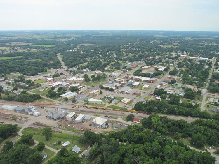
Geography
Pawnee is located at 36°20′11″N 96°48′5″W (36.336260, -96.801494). According to the United States Census Bureau, the city has a total area of 2.2 square miles (5.7 km2), all land.
Demographics
As of the census of 2000, there were 2,230 people, 878 households, and 581 families residing in the city. The population density was 1,015.4 people per square mile (391.4/km²). There were 1,054 housing units at an average density of 479.9 per square mile (185.0/km²). The racial makeup of the city was 63.18% White, 3.59% African American, 27.89% Native American, 0.18% from other races, and 5.16% from two or more races. Hispanic or Latino of any race were 1.03% of the population.
There were 878 households out of which 33.3% had children under the age of 18 living with them, 45.7% were married couples living together, 17.2% had a female householder with no husband present, and 33.8% were non-families. 32.0% of all households were made up of individuals and 16.5% had someone living alone who was 65 years of age or older. The average household size was 2.44 and the average family size was 3.08.
In the city, the population was spread out with 27.4% under the age of 18, 7.3% from 18 to 24, 24.4% from 25 to 44, 22.7% from 45 to 64, and 18.2% who were 65 years of age or older. The median age was 39 years. For every 100 females there were 84.3 males. For every 100 females age 18 and over, there were 80.6 males.
The median income for a household in the city was $24,962, and the median income for a family was $32,850. Males had a median income of $28,182 versus $20,139 for females. The per capita income for the city was $12,970. About 16.8% of families and 20.5% of the population were below the poverty line, including 25.9% of those under age 18 and 23.4% of those age 65 or over.
Government
Pawnee has an aldermanic form of government.
2016 earthquake
A 5.8-magnitude earthquake struck near Pawnee on September 3, 2016, causing cracks and minor damage to buildings. It was the strongest recorded earthquake in state history, exceeding the 5.7 magnitude 2011 earthquake near Prague, Oklahoma.