
Main source Maine315 feet (100 m) | River mouth Belfast Baysea level | |
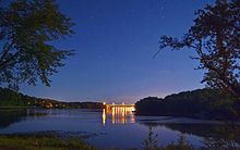 | ||
The Passagassawakeag River (/pæsəɡæsəˈwɑːkɛɡ/ pas-uh-gas-uh-WAH-keg or /pəˌsɑːɡæsəˈwɑːkɛɡ/ pa-SAH-ga-suh-WAH-keg) is a 16-mile-long (26 km) river in Waldo County, Maine in the United States. From the outlet of Lake Passagassawakeag (44°30′04″N 69°07′59″W) in Brooks, it runs south and east to its estuary in Belfast, Maine. The river empties into Belfast Bay, an inlet of Penobscot Bay, where it passes under US Route 1.
Map of Passagassawakeag River, Maine, USA
The waterway's name is of local Indian origin and is believed to mean "a sturgeon's place" or "a place for spearing sturgeon by torchlight."
References
Passagassawakeag River Wikipedia(Text) CC BY-SA