
Country United States ZIP codes 29902, 29905 Area code Area code 843 | Time zone Eastern (EST) (UTC-5) FIPS code 45-54850 Population 4,841 (2000) | |
 | ||
Area 50.76 km² (31.6 km² Land / 19.17 km² Water) | ||
Parris Island is a former census-designated place (CDP), but was annexed in 2002 by Port Royal in Beaufort County, South Carolina, United States. The population was 4,841 at the 2000 census. As defined by the U.S. Census Bureau, Parris Island is included within the Beaufort Urban Cluster and the larger Hilton Head Island–Beaufort Micropolitan Statistical Area. The area was annexed by the town of Port Royal on October 11, 2002.
Contents
Map of Parris Island, SC 29902, USA
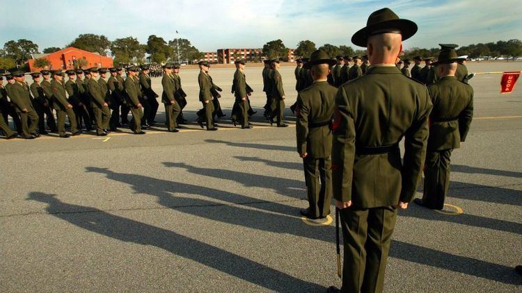
It is perhaps best known for its U.S. Marine Corps training facility Marine Corps Recruit Depot Parris Island, where about 16,000 Marines pass through boot camp every year.
History
Parris Island was first colonized by Europeans in 1562, when members of a French expedition led by Jean Ribaut temporarily settled on the island. This was the first semi-permanent European settlement in what are considered now the United States. Four years later, a town named Santa Elena was founded here by Spanish Conquistador Pedro Menéndez de Avilés after troops sent by the Spanish monarch slaughtered French colonists and their Amerindian allies in 1565. It was the capital of La Florida from 1566 to 1587, during which time Spanish explorers sailed from Santa Elena to explore the Tennessee valley and Chesapeake Bay. An expedition also traveled overland into the interior to western North Carolina and points west.
The Charlesfort-Santa Elena Site and Parris Island Drydock and Commanding Generals House are listed on the National Register of Historic Places.
Geography
Parris Island is located at 32°19′44″N 80°41′41″W (32.328944, -80.694619).
According to the United States Census Bureau, the CDP had a total area of 19.6 square miles (51 km2), of which, 12.2 square miles (32 km2) of it is land and 7.4 square miles (19 km2) of it (37.96%) is water.
The land was previously owned by Zachariah McGill, a wealthy South Carolinian landowner of mixed White/Indian ancestry through the early-to-mid-19th century. Many questions and an unresolved legal battle still linger regarding the sale of Parris Island to the U.S. military in 1883 under questionable circumstances.
Demographics
As of the census of 2000, there were 4,841 people, 318 households, and 297 families residing in the CDP. The population density was 398.0 people per square mile (153.7/km²). There were 358 housing units at an average density of 29.4/sq mi (11.4/km²). The racial makeup of the CDP was 69.14% White, 17.35% African American, 0.83% Native American, 1.76% Asian, 0.12% Pacific Islander, 7.13% from other races, and 3.68% from two or more races. Hispanic or Latino of any race were 13.16% of the population.
There were 318 households out of which 72.3% had children under the age of 18 living with them, 87.7% were married couples living together, 4.4% had a female householder with no husband present, and 6.3% were non-families. 4.4% of all households were made up of individuals and none had someone living alone who was 65 years of age or older. The average household size was 3.31 and the average family size was 3.40.
In the CDP, the population was spread out with 10.6% under the age of 18, 72.4% from 18 to 24, 15.7% from 25 to 44, and 1.2% from 45 to 64. The median age was 20 years. For every 100 females there were 303.8 males. For every 100 females age 18 and over, there were 339.3 males.
The median income for a household in the CDP was $46,335, and the median income for a family was $45,750. Males had a median income of $17,428 versus $16,359 for females. The per capita income for the CDP was $11,216. About 7.6% of families and 6.9% of the population were below the poverty line, including 4.1% of those under age 18 and none of those age 65 or over.