
Owned by City of New York Tracks 2 Closed June 8, 1962 Owner New York City | Line(s) Rockaway Beach Branch Station code None Opened 15 September 1927 Platforms in use 2 | |
 | ||
Location 9230 Metropolitan Avenue
Queens, New York City Similar Brooklyn Manor, Brooklyn Hills, Ozone Park, Woodhaven Junction, The Raunt | ||
Parkside is a former elevated Long Island Rail Road station on the north side of Metropolitan Avenue on the border of the Middle Village, Rego Park, Forest Hills, and Glendale neighborhoods in Queens, New York City. Opened in 1927, the wooden station was part of the Rockaway Beach Branch and was the northernmost station on the branch before the junction with the Main Line at Rego Park Station and the terminus of the line at Grand Street Station in Elmhurst. The station was closed in 1962, twelve years after the LIRR had abandoned the Rockaway portions of the line.
Contents
Station layout
The station had two tracks and two wooden high-level side platforms, with four small wooden shelters on both platforms. Exit stairs were located on Metropolitan Avenue.
North of the station, the line veered west to merge with the LIRR Main Line at Whitepot Junction. Just south of the station near the Union Turnpike overpass was a junction with the Montauk Branch (Glendale Junction), with a wye from the westbound Montauk track merging with the Rockaway Branch going north, and another from the eastbound Montauk track going south. The Rockaway line, meanwhile, ran elevated over the Montauk branch on a wooden trestle.
Operation
Prior to the construction of the station, Rockaway Beach Branch service north of Ozone Park traveled via the Atlantic Branch to Flatbush Terminal, or the Montauk Branch to Hunters Point Ferry. Between 1908 and 1911, the branch was extended north past the Montauk Branch to the Main Line; this new grade-separated section was known as the Glendale Cut-off, and allowed service from the branch to Penn Station in Manhattan. In early 1927, a new station was conceived at Metropolitan Avenue along the cut-off to alleviate congestion at the Forest Hills Main Line station, and to replace the nearby Glendale station and Atlas Yard station (the current site of The Shops at Atlas Park at Cooper Avenue) on the Montauk Branch. The station was opened on September 15, 1927. It was originally named "Glendale" as a substitute for the former station on the Montauk Branch. It was renamed "Parkside" on October 23, 1927, due to its proximity to Forest Park, after protests over the station name from the local community. The Parkside name is shared with a nearby post office at Metropolitan Avenue and Continental Avenue (71st Avenue).
The opening of the Parkside station helped spawn development in the area, which was previously empty lots and farmland. Over 100 homes were constructed to form the Forest Hills Crest community. The block immediately to the south of the station, bound by Metropolitan Avenue, Woodhaven Boulevard, and Union Turnpike became an industrial superblock.
In the early expansion plans of the city's Independent Subway System in the 1930s, Parkside was one of the stations that would have been absorbed into the new subway, connecting to the IND Queens Boulevard Line at its 63rd Drive station in Rego Park, north of the LIRR Main Line junction.
Closure and current state
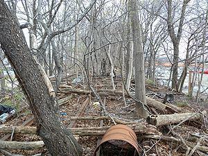
Following the condemning of the Rockaway Beach Branch by the LIRR in 1950 due to a fire, and the city's purchase of the line in 1955, only the route south of Liberty Avenue was reactivated as a subway line (today's IND Rockaway Line). LIRR service continued through Parkside to Ozone Park, although greatly reduced. Due to vandalism, the railroad removed the station's southbound track and put both platforms out of service in 1958, replaced with a low-level concrete platform in the former trackbed. The Rockaway Beach Branch ceased operations on June 8, 1962 and all stations along the line were closed. No trace of the station exists today.
The vicinity of the former station is located near the Forest Hills Volunteer Ambulance Corps. The former industrial block west of the line is currently a shopping center. The land east of the line south of Metropolitan Avenue is currently the site of the Metropolitan Avenue Public School Campus built from 2006 to 2010; the northern entrance to the campus is on Metropolitan Avenue, and the school building sits on the former right-of-way of the northern Montauk connection. The southern wye is used by baseball fields. The overpass above the Montauk branch has been demolished. Shortly after the opening of the Metropolitan campus in 2010, the trestle and overpass over Metropolitan Avenue near the school were deemed to be structurally unsound in a report by the Vornado Realty Trust.