Trisha Shetty (Editor)

Parks in Halifax, Nova Scotia

Updated on
Edit
Like
Comment
Share on FacebookTweet on TwitterShare on LinkedInShare on Reddit
Parks in Halifax, Nova Scotia

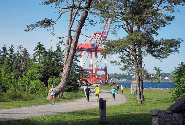
The Halifax Regional Municipality has a number of parks and recreation areas in urban and rural settings.

Contents

Urban and suburban parks

  • Admiral's Cove Park 44°43′1.8″N 63°39′6″W
  • Admiral Harry DeWolf Park 44°42′59.1″N 63°40′15″W
  • Africville Park (formerly Seaview Park) 44°40′29.7″N 63°37′7″W
  • Albro Lake Park 44°41′10.6″N 63°34′31.9″W
  • Arnold Witwork Park 44°39′33.09″N 63°32′52.53″W
  • Ashley Cheeseman Memorial Park
  • Beazley Park 44°41′14.7″N 63°31′56.8″W
  • Bedford Lions Sandy Lake Park 44°44′10.5″N 63°41′42.6″W
  • Bell Lake Park 44°40′37.2″N 63°30′34.9″W
  • Birch Cove 44°40′46.6″N 63°33′42.3″W
  • Bissett Lake Park 44°39′30.2″N 63°27′47.3″W
  • Brownlow Park (in Manor Park) 44°40′18.1″N 63°32′36.3″W
  • Charlie Park 44°47′19.2″N 63°36′45.6″W
  • Chocolate Lake 44°38′18.5″N 63°37′25.3″W
  • City Waterfront Park, Dartmouth 44°39′47.8″N 63°34′4″W
  • Halifax Common (The Common) 44°38′57.86″N 63°35′21.39″W
  • Conrose Field (The Horsefields) 44°38′19.7″N 63°36′4.3″W
  • Cornwallis Park 44°38′23″N 63°34′10.4″W
  • Cyril Smith Golden Acres Park 44°41′26.9″N 63°34′31.2″W
  • Crawthorne Park 44°40′12.7″N 63°35′4.8″W
  • Dartmouth Common 44°40′8.72″N 63°34′17.72″W
  • Deadman's Island Park 44°38′5.95″N 63°36′36.09″W
  • Eastern Passage Commons 44°36′29.1″N 63°28′29.5″W
  • Findley Community Park 44°40′19.3″N 63°33′38.8″W
  • Flinn Park 44°38′30.3″N 63°36′46.1″W
  • Forest Hills Commons 44°41′5.2″N 63°29′18″W
  • Farrell Park 44°40′33.9″N 63°35′23.2″W
  • Grahams Cove 44°40′51.6″N 63°32′59.8″W
  • Gorsebrook Park 44°38′03.8″N 63°34′55.9″W
  • Graves-Oakley Memorial Park 44°35′48.6″N 63°37′37.4″W
  • Hemlock Ravine 44°41′20.9″N 63°40′3.3″W
  • Horseshoe Island Park 44°38′23″N 63°36′46.6″W
  • J. Albert Walker Sports Field 44°37′42.4″N 63°37′28.2″W
  • Jason MacCullough Park
  • Larry O'Connell Field 44°38′45.2″N 63°36′31.4″W
  • Mainland Common 44°39′24.9″N 63°39′46.3″W
  • Mary Clayton Memorial Park
  • Maybank Park 44°41′8.1″N 63°34′1.2″W
  • Merv Sullivan Park 44°40′16.9″N 63°36′39.1″W
  • Millers Mountain Park 44°41′28.9″N 63°32′27.6″W
  • Northbrook Park 44°40′30.8″N 63°34′54.3″W
  • Old Hill Lake Park 44°40′26″N 63°32′59″W
  • Oleary Drive Park 44°48′26.1″N 63°40′13.2″W
  • Owls Nest Island - Little Micmac Park 44°41′19.5″N 63°33′3.5″W
  • Penhorn Lake Beach Park 44°40′32.3″N 63°32′22.8″W
  • Perrin Road Park 44°49′41.9″N 63°35′1.4″W
  • Pinehill Lookoff Park 44°41′16″N 63°35′6″W
  • Point Pleasant Park 44°37′22″N 63°34′9″W
  • Public Gardens 44°38′34″N 63°34′56″W
  • Russell Lake Park 44°40′6.2″N 63°31′34.1″W
  • Saunders Park (Chebucto Park)44°38′45.2″N 63°36′40″W
  • Schwarzwald Park 44°50′6.5″N 63°35′55.4″W
  • Shubie Park 44°42′5.3″N 63°33′26.7″W
  • Sir Sandford Fleming Park (The Dingle)44°37′41.1″N 63°36′7.2″W
  • Sullivan's Pond 44°40′18.8″N 63°33′48″W
  • Tremont Park 44°40′30.8″N 63°39′23.6″W
  • Urban Widerness Park 44°40′14.7″N 63°34′26″W
  • Victoria Park 44°38′27.9″N 63°34′46.6″W
  • Yetter Park 44°40′34.8″N 63°35′28″W
  • Wilderness areas

  • Boggy Lake Wilderness Area 45°5′21″N 62°18′36″W
  • Clattenburgh Brook Wilderness Area 44°51′54.7″N 63°24′53.1″W
  • Peggys Cove Preservation Area44°29′55.8″N 63°55′4.6″W
  • Ship Harbour Long Lake Wilderness Area 44°50′17″N 63°04′32″W
  • Tangier Grand Lake Wilderness Area 44°52′26.5″N 62°48′20.2″W
  • Terence Bay Wilderness Area 44°32′45.2″N 63°41′6.6″W
  • Waverley-Salmon River Long Lake Wilderness Area 44°47′17″N 63°27′37″W
  • White Lake Wilderness Area 44°51′28.7″N 63°9′30″W
  • Game sanctuaries

  • Liscomb Game Sanctuary 45°5′0″N 62°25′54″W
  • Waverley Game Sanctuary 44°49′29″N 63°32′10″W
  • National parks

  • Sable Island National Park Reserve 43°57′00″N 59°54′57″W
  • Provincial parks

  • Clam Harbour Beach Provincial Park 44°43′53″N 62°53′28″W
  • Cleveland Beach Provincial Park 44°39′5″N 63°59′59″W
  • Cole Harbour -Lawrencetown Coastal Heritage Park System [1]
  • Salt Marsh Trail 44°40′6.6″N 63°25′21.6″W
  • Lawrencetown Beach Provincial Park 44°38′39″N 63°20′27″W
  • Rainbow Haven Beach Provincial Park 44°38′58″N 63°25′4″W
  • Crystal Crescent Beach Provincial Park 44°27′36″N 63°37′12″W
  • Dollar Lake Provincial Park 44°55′49″N 63°19′7″W
  • Elderbank Provincial Park 44°58′49″N 63°12′58″W
  • Gibraltar Rock Provincial Park Reserve44°48′16.73″N 63°10′29.97″W
  • Herring Cove Provincial Park Reserve
  • Laurie Provincial Park 44°53′2″N 63°36′6″W
  • Lewis Lake Provincial Park 44°41′21″N 63°50′46″W
  • Long Lake Provincial Park 44°37′2.89″N 63°38′7.03″W
  • Martinique Beach Provincial Park 44°41′34″N 63°7′50″W
  • McCormack Beach Provincial Park 44°36′28.4″N 63°29′32.3″W
  • McNabs Island Provincial Park 44°37′0″N 63°31′57″W
  • Moose River Gold Mines Provincial Park 44°58′52″N 62°56′27″W
  • Musquodoboit Valley Provincial Park 45°3′18″N 63°6′44″W
  • Oakfield Provincial Park 44°54′55″N 63°35′14″W
  • Porters Lake Provincial Park 44°41′16″N 63°18′5″W
  • Powder Mill Lake Provincial Park 44°46′29″N 63°36′38″W
  • Queensland Beach Provincial Park 44°38′8″N 64°1′35″W
  • Taylors Head Provincial Park 44°49′22″N 62°34′30″W
  • William E. Degarthe Provincial Park 44°29′37″N 63°54′51″W
  • Rural

  • Kidstone Lake/ Rockingstone Park 44°35′48.3″N 63°37′8.3″W
  • Moser River Seaside Park 44°58′19.7″N 62°15′15.1″W
  • Oceanic Drive Park 44°38′47.5″N 63°19′49.2″W
  • Second Lake 44°46′12.9″N 63°38′54.6″W
  • West River Sheet Harbour Picnic Park 44°55′40.1″N 62°32′48.7″W
  • National historic sites

  • Halifax Citadel National Historic Site (The Citadel)44°38.9′N 63°34.8′W
  • Fort Charlotte National Historic Site 44°38′28.6″N 63°33′35″W
  • Fort McNab National Historic Site 44°36′0.8″N 63°30′53.5″W
  • York Redoubt National Historic Site 44°35′47.7″N 63°33′8.78″W
  • Prince of Wales Tower National Historic Site of Canada 44°37′15″N 63°34′5″W
  • Trails

  • Atlantic View Trail 44°38′41.2″N 63°20′7.5″W
  • Beechville Lakeside Timberlea Rails to Trails 44°39′59.3″N 63°46′35.2″W
  • Bissett Road Trail 44°38′10.7″N 63°27′23.3″W
  • Blueberry Run Trail 44°40′5.3″N 63°15′38.6″W
  • Chain of Lakes Trail
  • Dartmouth Harbourfront Walkway 44°39′17.9″N 63°33′9.4″W
  • DeWolfe Park Boardwalk 44°42′55.4″N 63°40′18.2″W
  • Fort Sackville Walkway44°44′29.8″N 63°39′31.6″W
  • Frog Pond Trail44°37′33.4″N 63°36′13.6″W
  • Little Sackville River Greenway 44°43′48″N 63°39′42.5″W
  • Lake Charles, Nova Scotia Trail 44°42′54.1″N 63°33′6.9″W
  • Mainland North Linear Parkway 44°39′38.3″N 63°39′40.2″W
  • McCurdy Woodlot Trails 45°2′58.7″N 63°8′39.5″W
  • Moser River Interpretive Trail 44°57′27.3″N 62°14′55″W
  • Musquodoboit Trail System 44°47′37.1″N 63°9′2.1″W
  • Nova Scotia Coastal Water Trail 44°38′27.1″N 64°4′1.1″W
  • Old Annapolis Road Hiking Trail 44°41′52.2″N 63°53′17.1″W
  • Pennant Point Trail 44°26′52.1″N 63°37′23.2″W
  • Polly's Cove Trail 44°29′24.5″N 63°53′24.7″W
  • Portland Lakes Trail 44°40′7.2″N 63°31′38.1″W
  • Salmon River Trail 44°45′44.4″N 63°24′0.5″W
  • Salt Marsh Trail 44°40′6.6″N 63°25′21.6″W
  • Spider Lake Trail 44°44′46.4″N 63°32′19.2″W
  • References

    Parks in Halifax, Nova Scotia Wikipedia