
Country Greece Lowest elevation 1 m (3 ft) Postal code 601 00 Local time Wednesday 10:28 PM Municipality Katerini Regional unit Pieria | Highest elevation 20 m (70 ft) Time zone EET (UTC+2) Vehicle registration KN Area code 23510 Administrative region Central Macedonia | |
 | ||
Weather 14°C, Wind SW at 6 km/h, 59% Humidity | ||
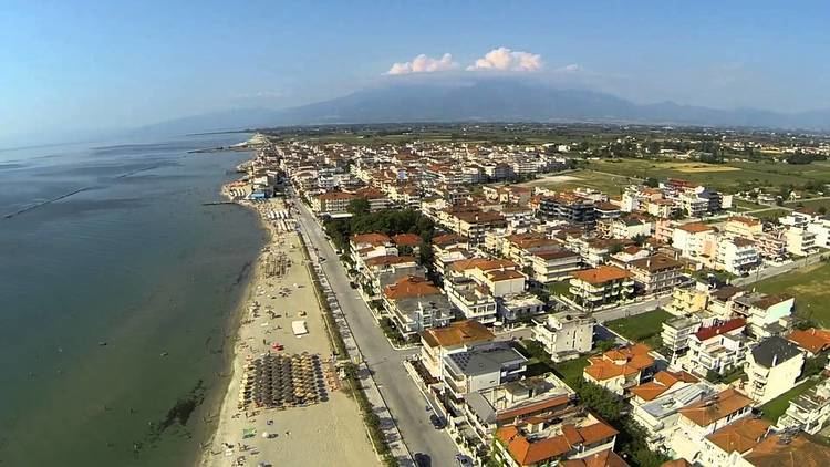
Paralia (Greek: Παραλία) is a tourist seaside village and a former municipality in the eastern part of the Pieria regional unit, Greece. Since the 2011 local government reform it is part of the municipality Katerini, of which it is a municipal unit. The seat of the municipality was in Kallithea. The 2011 census reported a population of 1,124 for the village of Paralia, and 6,803 for the municipal unit. The municipal unit has an area of 24.344 km2, the community 1.849 km2.
Contents
Map of Paralia 601 00, Greece
Geography
Paralia is situated on the west coast of the Thermaic Gulf. It lies 2 km east of Kallithea, 5 km south of Korinos and 8 km east of Katerini. Motorway 1 and the Piraeus–Platy railway (nearest station at Katerini) pass west of the village. Paralia has a small port.
References
Paralia, Pieria Wikipedia(Text) CC BY-SA