
Prominence 1,653 m (5,423 ft) First ascent pre-Columbian Listing Ultra-prominent peak | Last eruption Unknown Elevation 5,960 m Parent range Andes | |
 | ||
Similar Cerro del León, Cerro del Azufre, Caichinque, Cordón de Puntas Negras, Chiliques | ||
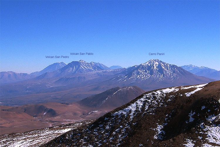
Paniri (Aymara) is a stratovolcano located in El Loa Province, Antofagasta Region, Chile, and near the border with Bolivia. To its northwest lie the twin volcanoes San Pedro and San Pablo, and to its southeast lies Cerro del León, from which it is separated by the huge Chao lava dome.
Map of Paniri, Calama, Antofagasta Region, Chile
Claudio Lucero and Nelson Muñoz made the first recorded ascent of Paniri in 1972. They found archaeological remains on its summit.
References
Paniri Wikipedia(Text) CC BY-SA