
Area 2,606 km² Local time Wednesday 6:57 AM | Time zone GMT +5 (UTC+5) Founded 1942 Population 41,754 (2009) | |
 | ||
Weather 4°C, Wind E at 2 km/h, 81% Humidity | ||
Panfilov is a raion (district) of Chuy Region in northern Kyrgyzstan. Its area is 2,606 square kilometres (1,006 sq mi), and its resident population was 41,754 in 2009. The capital lies at Kayyngdy (Kaindy). The district covers the westernmost part of the Chuy Region, and a mountainous exclave separated from the rest of the Panfilov District by the Jayyl District.
Contents
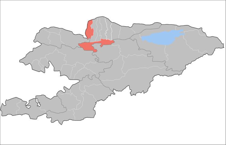
Map of Panfilov District, Kyrgyzstan
Rural communities, and villages
Panfilov District comprises 1 city and 20 villages in 6 rural communities (aiyl okmotus). Each rural community includes one or several villages. The rural communities in Panfilov District and settlements are as follows:
- city Kaindy
- Voznesenovka aiyl okmotu (center - village Voznesenovka, and also villages Orto-Kayyrma, and Erkin-Say)
- Kürpüldök aiyl okmotu ( center - village Kürpüldök, and also villages Imeni Kirova, and Rovnoye)
- Ortoev aiyl okmotu (center - village Imeni Telmana, and also villages Bukara, and Kum-Aryk)
- Kurama aiyl okmotu ( center - village Panfilovskoye, and also villages Jayylma, Orto-Aryk, and Efironos)
- Frunze aiyl okmotu (center - village Chaldybar and also villages Cholok-Aryk, and Chorgolu)
- Chaldybar aiyl okmotu ( center - village Pervomayskoye and also villages Ozernoye, Oktyabrskoye and Oyrondu)
References
Panfilov District, Kyrgyzstan Wikipedia(Text) CC BY-SA