
Country United States County Le Flore Area code(s) 539/918 Elevation 138 m Zip code 74951 Local time Tuesday 3:42 PM | Time zone Central (CST) (UTC-6) FIPS code 40-56900 Area 250 ha Population 1,383 (2013) | |
 | ||
Weather 31°C, Wind SW at 13 km/h, 32% Humidity | ||
Panama is a town in Le Flore County, Oklahoma, United States. It is part of the Fort Smith, Arkansas-Oklahoma Metropolitan Statistical Area. The population was 1,413 at the 2010 census.
Contents
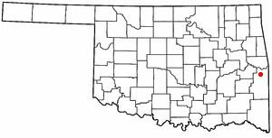
Map of Panama, OK, USA
History
This town began as a coal mining community named Red Town because all of the miners' shacks were painted red. The origin of the town name is uncertain. Some historians claim that the name was inspired by the building of the Panama Canal, but the town was already called Panama by 1898. The site for the canal was not selected until 1902, so this claim seems unfounded. In 1896 the Kansas City, Pittsburg and Gulf Railroad (acquired by the Kansas City Southern Railway in 1900) built a north-south line through the region. The Midland Valley Railroad built an east-west line through the region in 1903-1904. The town of Panama moved to the crossing of the two railroads. The Panama post office first opened January 14, 1898, but the order was rescinded for some unknown reason on February 23, 1898. The post office reopened February 21, 1899.
Panama was still supported by coal mining in 1930. The Ozark Coal and Mining Company had established itself there in 1898, however the coal mines began to close in the 1930s. A creosote plant, established in 1937, provided some jobs for the former miners. The Panama Coal Company, which had engaged in strip mining, went bankrupt in 1977.
Geography
Panama is located at 35°10′14″N 94°40′12″W (35.170591, -94.670099). It is 9 miles (14 km) north of Poteau on Highway 59.
According to the United States Census Bureau, the town has a total area of 1.5 square miles (3.9 km2), of which 0.66% is water.
Demographics
As of the census of 2010, there were 1,413 people, 530 households, and 364 families residing in the town. The population density was 903.0 people per square mile (348.3/km²). There were 626 housing units at an average density of 415.1 per square mile (160.1/km²). The racial makeup of the town was 78.27% White, 13.09% Native American, 0.35% Asian, 2.12% from other races, and 5.52% from two or more races. Hispanic or Latino of any race were 4.53% of the population.
There are 530 households, of which 34.7% have children under the age of 18 living with them, 49.6% were married couples living together, 15.5% have a female head of family, and 31.3% were non-families. 26.4% of all households were made up of individuals and 12.5% have a person 65 years of age or older living alone. The average household size was 2.57 people; the average family size is 3.12 people.
In the town, the population was spread out with 29.1% under the age of 18, 9.3% from 18 to 24, 26.9% from 25 to 44, 21.3% from 45 to 64, and 14.93% 65 years of age or older. The median age is 34 years. For every 100 females there were 90.0 males. For every 100 females age 18 and over, there were 90.2 males.
The median income for a household in the town was $23,385, and the median income for a family was $29,500. Males had a median income of $27,260 versus $17,679 for females. The per capita income for the town was $12,878. About 19.2% of families and 24.3% of the population were below the poverty line, including 30.8% of those under age 18 and 18.8% of those age 65 or over.
In popular culture
On February 13, 2013, the American Pickers came to town.