
Country Cyprus Time zone EET (UTC+2) Local time Tuesday 9:59 PM | District Pafos District Elevation 900 m Population 564 (2001) | |
 | ||
Weather 9°C, Wind E at 5 km/h, 90% Humidity | ||
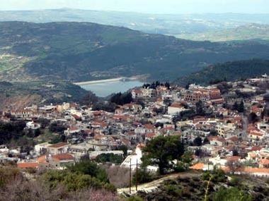
Pano Panayia (Greek: Πάνω Παναγιά), also known as Panayia (Greek: Παναγιά), is a mountainous village in Cyprus, located at an altitude of 900 metres in the Paphos mountain range, on the outskirts of Paphos forest and 35 minutes from Paphos International Airport. The name Panayia refers to Mary, mother of Jesus Christ.
Map of Pano Panagia, Cyprus
Panayia owes its name to the many churches and monasteries, which are in the village or close to it and which are dedicated to Virgin Mary(which in Greek is called Panayia). The most known are the ancient church of Panayia Eleousa in the centre of the village, the historical Chrysoroyiatissa Monastery and of course the Byzantine Monastery of Panayia tou Kykkou.
Archbishop Makarios III, the first president of the Republic of Cyprus, was born in Panayia in 1913.
The village is also known for its unique wildlife, among which, the Mouflon is protected by Cyprus and International laws as an endangered species. It is also known for the viticultural zone called Vouni Panayias, which is considered by the wine conoisseurs as the best in the island.
By the 2001 census Panayia had a total population of 564.