
Country United States FIPS code 38-60620 Elevation 673 m Zip code 58769 Population 82 (2013) | Time zone Central (CST) (UTC-6) GNIS feature ID 1030621 Area 5.72 km² Local time Tuesday 3:36 AM Area code 701 | |
 | ||
Weather -7°C, Wind NE at 13 km/h, 100% Humidity | ||
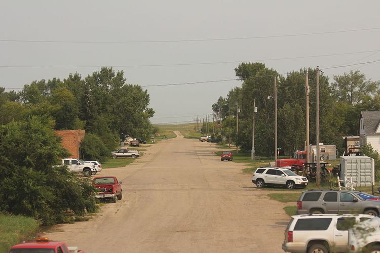
Un altra america palermo north dakota
Palermo (/ˈpælərmoʊ/ PAL-ər-moh) is a city in Mountrail County, North Dakota, United States. The population was 74 at the 2010 census. Palermo was founded in 1902.
Contents
- Un altra america palermo north dakota
- Map of Palermo ND USA
- How to say or pronounce usa cities palermo north dakota
- Geography
- 2010 census
- 2000 census
- References
Map of Palermo, ND, USA
How to say or pronounce usa cities palermo north dakota
Geography
Palermo is located at 48°20′22″N 102°13′47″W.
According to the United States Census Bureau, the city has a total area of 2.21 square miles (5.72 km2), all of it land.
2010 census
As of the census of 2010, there were 74 people, 39 households, and 18 families residing in the city. The population density was 33.5 inhabitants per square mile (12.9/km2). There were 67 housing units at an average density of 30.3 per square mile (11.7/km2). The racial makeup of the city was 95.9% White, 1.4% African American, 1.4% Native American, and 1.4% from two or more races. Hispanic or Latino of any race were 1.4% of the population.
There were 39 households of which 15.4% had children under the age of 18 living with them, 35.9% were married couples living together, 7.7% had a female householder with no husband present, 2.6% had a male householder with no wife present, and 53.8% were non-families. 51.3% of all households were made up of individuals and 7.7% had someone living alone who was 65 years of age or older. The average household size was 1.90 and the average family size was 2.83.
The median age in the city was 49.5 years. 14.9% of residents were under the age of 18; 9.5% were between the ages of 18 and 24; 16.3% were from 25 to 44; 37.9% were from 45 to 64; and 21.6% were 65 years of age or older. The gender makeup of the city was 59.5% male and 40.5% female.
2000 census
As of the census of 2000, there were 77 people, 38 households, and 22 families residing in the city. The population density was 35.2 people per square mile (13.6/km2). There were 53 housing units at an average density of 24.2 per square mile (9.3/km2). The racial makeup of the city was 97.40% White, 1.30% Asian, and 1.30% from two or more races.
There were 38 households out of which 18.4% had children under the age of 18 living with them, 52.6% were married couples living together, 5.3% had a female householder with no husband present, and 39.5% were non-families. 39.5% of all households were made up of individuals and 26.3% had someone living alone who was 65 years of age or older. The average household size was 2.03 and the average family size was 2.65.
In the city, the population was spread out with 18.2% under the age of 18, 3.9% from 18 to 24, 18.2% from 25 to 44, 23.4% from 45 to 64, and 36.4% who were 65 years of age or older. The median age was 51 years. For every 100 females there were 83.3 males. For every 100 females age 18 and over, there were 96.9 males.
The median income for a household in the city was $33,125, and the median income for a family was $35,313. Males had a median income of $27,500 versus $22,500 for females. The per capita income for the city was $14,028. There were no families and 2.4% of the population living below the poverty line, including no under eighteens and none of those over 64.