
Built 1795 (1795) Opened 1795 Added to NRHP 11 April 1985 | NRHP Reference # 85000731 Area 6 ha | |
 | ||
Location ME 113, Standish, Maine | ||
The Paine Neighborhood Historic District of Standish, Maine encompasses a small collection of rural properties that were all developed within a short period of time by members of the Paine family. Included are three late-18th-century houses and the family cemetery. The area provides a view of early settlement patterns in Maine's interior. The district was listed on the National Register of Historic Places in 1985.
Description and history
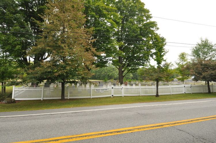
In about 1780 four Paine brothers left Eastham, Massachusetts, and settled in the area that is now Gorham and Standish, Maine. One of them, Joseph, settled on the Pequawket Trail (now Maine State Route 113), the major historic route from coastal southern Maine to the Fryeburg area, on the northeast side of Watchic Pond. Although his early home no longer stands, four sons all built houses in the 1790s, three of which still stand along Route 113, along with the family cemetery.
The family cemetery is located on the north side of Route 113. To its east stands the house of Myrick Paine, a two story wood frame structure with a hip roof and four chimneys. To its west is that of Richard Paine, a 1-1/2 story Cape style house with an attached single-story wing. South of the road, roughly opposite Richard's house, is the house of Joseph Paine, Jr. It is similar to Richard's, except that it is connected to a barn. All three houses were built 1795-97, and remained in the hands of Paine descendants into the 20th century.