
Topo map USGS Cap Mountain Prominence 167 m Mountain range Hueco Mountains | Elevation 496 m | |
 | ||
Similar Spy Rock, Granite Mountain, Slipdown Mountain, Emory Peak | ||
Named after the saddle-like appearance provided by twin peaks, Packsaddle Mountain is a landmark hill that stands five miles southwest of Kingsland, Texas in eastern Llano County on State Highway 71 and is of interest to both historians and geologists. In 1873 it was the site of the Packsaddle Mountain Fight, the last major Native American battle in the area. The mountain is now part of a large ranch called Packsaddle Ranch.
Contents
Map of Packsaddle Mountain, Texas 78639, USA
HistoryEdit
It is thought that the Spanish mined the mountain for gold prior to the Texas Revolution and that it was the site of Los Almagres, Jim Bowie’s famous lost mine. Prospecting on Packsaddle Mountain renewed interest in gold mining in Llano County in the 1920s, but with no lasting result.
The mountain was the site of the Packsaddle Mountain Fight with Texas Native Americans on August 4, 1873 and was the last major Native american battle in the area. The fight on Packsaddle Mountain was precipitated when a woman from the Moss Ranch (in what is now Llano County) came into the ranch house with an arrow sticking out of her side. A party of eight ranchers, including W.B. Moss and his two brothers, was raised to pursue the Native Americans. They found some twenty-one Native Americans encamped on Packsaddle Mountain. In the ensuing fight at least three Native Americans were killed and three ranchers wounded.
The Texas state historical marker reads "Two and one half miles east on the Packsaddle Mountain, in a battle fought August 4, 1873, Captain J. R. Moss, Stephen B. Moss, William B. Moss, Eli Lloyd, Arch Martin, Pink Ayers, E. D. Harrington and Robert Brown routed a band of Native Americans thrice their number. The last Native American battle in this region."
GeographyEdit
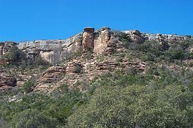
At an elevation of 1,628 feet, the higher of the two summits rises 650 feet above Highway 71. Local topography ranges from flat to rolling to steep, with local escarpments, covered with soils ranging from shallow and stony to deep, fine, sandy loam. Vegetation consists primarily of open stands of live oak and Ashe juniper.