
Population 14,788 (2011 census) Postal code 4211 | Postcode(s) 4211 | |
 | ||
Gold coast unique opportunity 7 zenith crescent pacific pines queensland
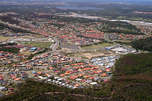
Pacific Pines is a suburb on the Gold Coast in Queensland, Australia. It is located between the Pacific Motorway (M1) and the NNE side of the Nerang State Forest. At the 2011 Census, Pacific Pines had a population of 14,788.
Contents
- Gold coast unique opportunity 7 zenith crescent pacific pines queensland
- Map of Pacific Pines QLD 4211 Australia
- History
- Nature
- References
Map of Pacific Pines QLD 4211, Australia
History
Pacific Pines was originally part of Gaven, Queensland; but became a separate suburb in 2003. Stockland bought the 800ha land in 1990 and designed it as a residential area with the capacity for 5,800 house lots and various community areas/features (e.g. parks, taverns, BBQ's).
Nature
A part of Pacific Pines is located next to the Nerang National Park. There are many types of native and non-native animals located throughout the suburb. Some of these animals include kangaroos, various types of snakes, lizards, birds and wallabies. Non-Native animals have been introduced into to the close by Nerang National Park and therefore have spread to many parts of the area. Some of these animals include the European rabbit, fallow deer, European fox and the cane toad.