
Quadrant NW Sector North Elevation 686 m Population 4,495 (2012) | Ward 3 Area 112 ha | |
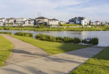 | ||
Ozerna is a neighbourhood in northeast Edmonton, Alberta, Canada. Subdivision and development of the neighbourhood is guided by the Ozerna Neighbourhood Structure Plan (NSP).
Contents
Map of Ozerna, Edmonton, AB, Canada
It is located within Edmonton's Lake District and was originally considered Neighbourhood 6 within the Edmonton North Area Structure Plan (ASP).
Ozerna is bounded by the Mayliewan neighbourhood to the west, the Schonsee neighbourhood across 167 Avenue to the north, the Matt Berry neighbourhood across 66 Street to the east, and the Kilkenny neighbourhood across 153 Avenue to the south.
Demographics
In the City of Edmonton's 2012 municipal census, Ozerna had a population of 7003449500000000000♠4,495 living in 7003139400000000000♠1,394 dwellings, a -1.3% change from its 2009 population of 7003455200000000000♠4,552. With a land area of 1.12 km2 (0.43 sq mi), it had a population density of 7003401340000000000♠4,013.4 people/km2 in 2012.
Housing
In 2005, Ozerna's housing breakdown consisted of 78% single-family dwellings, 12% duplexes, 10% low-rise apartments (fewer than five storeys), and 1% row houses. I