
- left Savita, Yabacao Length 148 km Mouth elevation 0 | Basin area 2,685 km² | |
 | ||
- location Caribbean Sea, Dominican Republic Bridges Puente francisco del rosario sanchez.., Puente Juan Bosch Provinces Monte Plata Province, Santo Domingo Province | ||
The Ozama River (Spanish: Rio Ozama) in the Dominican Republic can trace its source to the Loma Siete Cabezas in the Sierra de Yamasá close to Villa Altagracia.
Map of Rio Ozama, Dominican Republic
In 1498, Bartolome Colon had a fort built on the Ozama. The estuary at that time, "teemed with fish and where the Indians raised cassava and yams," according to Floyd.
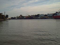
The river flows 148 kilometers (92 mi) before emptying into the Caribbean Sea. At the end of the journey it bisects the capital, Santo Domingo, into eastern and western halves. The three main tributaries of the Ozama are the Isabela River, the Sabita River and the Yabacao River.
The Ozama's basin is the fourth largest in the Dominican Republic. The river has several tributaries, with a combined area of 2,706 square kilometers (1,045 sq mi). The river basin has an annual precipitation of 2,250 mm (89 in) per year.
The basin is heavily contaminated by untreated industrial runoff and raw sewage.