
OS grid reference SK293780 Post town HOLMESFIELD | Sovereign state United Kingdom Postcode district S17 | |
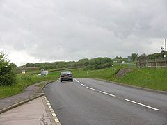 | ||
Owler Bar is a small area of settlement and locally important road junction in Derbyshire, England. It lies at an altitude of 305 metres and is located just south of the county border with Sheffield, on the edge of the Peak District National Park. It lies five miles west of the town of Dronfield and is where the A 621, B6054 and B6051 roads meet. The junction of the roads takes the form of an unusually large 'roundabout' or one-way system.
Map of Owler Bar, Sheffield, UK
Despite its small size, the hamlet has two pubs: the Peacock and the Moorlands. A cairn lies immediately north of the hamlet. Notable residents have included rambler G. H. B. Ward.
References
Owler Bar Wikipedia(Text) CC BY-SA