
Country United States FIPS code 19-60555 Elevation 330 m Zip code 50126 Local time Tuesday 1:32 PM | State Iowa Time zone Central (CST) (UTC-6) GNIS feature ID 0459973 Area 145 ha Population 43 (2013) Area code 641 | |
 | ||
Weather 12°C, Wind SE at 8 km/h, 69% Humidity | ||
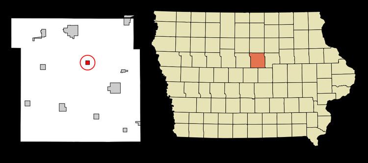
Owasa is a city in Hardin County, Iowa, United States. The population was 43 at the 2010 census.
Contents
Map of Owasa, IA 50126, USA
History
Owasa was platted in 1883 when the railroad was extended to that point. The name is derived from the Fox language, meaning "bear".
Geography
Owasa is located at 42°25′55″N 93°12′19″W (42.432053, -93.205359).
According to the United States Census Bureau, the city has a total area of 0.56 square miles (1.45 km2), all of it land.
2010 census
As of the census of 2010, there were 43 people, 17 households, and 9 families residing in the city. The population density was 76.8 inhabitants per square mile (29.7/km2). There were 19 housing units at an average density of 33.9 per square mile (13.1/km2). The racial makeup of the city was 90.7% White and 9.3% from two or more races.
There were 17 households of which 41.2% had children under the age of 18 living with them, 35.3% were married couples living together, 5.9% had a female householder with no husband present, 11.8% had a male householder with no wife present, and 47.1% were non-families. 29.4% of all households were made up of individuals and 5.9% had someone living alone who was 65 years of age or older. The average household size was 2.53 and the average family size was 3.44.
The median age in the city was 35.3 years. 32.6% of residents were under the age of 18; 7% were between the ages of 18 and 24; 27.9% were from 25 to 44; 25.6% were from 45 to 64; and 7% were 65 years of age or older. The gender makeup of the city was 44.2% male and 55.8% female.
2000 census
As of the census of 2000, there were 38 people, 17 households, and 8 families residing in the city. The population density was 67.3 people per square mile (26.2/km²). There were 19 housing units at an average density of 33.7 per square mile (13.1/km²). The racial makeup of the city was 100.00% White.
There were 17 households out of which 35.3% had children under the age of 18 living with them, 47.1% were married couples living together, and 47.1% were non-families. 35.3% of all households were made up of individuals and 23.5% had someone living alone who was 65 years of age or older. The average household size was 2.24 and the average family size was 2.89.
In the city, the population was spread out with 21.1% under the age of 18, 10.5% from 18 to 24, 31.6% from 25 to 44, 23.7% from 45 to 64, and 13.2% who were 65 years of age or older. The median age was 32 years. For every 100 females there were 137.5 males. For every 100 females age 18 and over, there were 114.3 males.
The median income for a household in the city was $35,417, and the median income for a family was $75,938. Males had a median income of $26,250 versus $22,500 for females. The per capita income for the city was $17,047. There were no families and 6.5% of the population living below the poverty line, including no under eighteens and 40.0% of those over 64.