Rahul Sharma (Editor)

Outline of South Dakota territorial evolution

Updated on
Edit
Like
Comment
Share on FacebookTweet on TwitterShare on LinkedInShare on Reddit
Outline of South Dakota territorial evolution

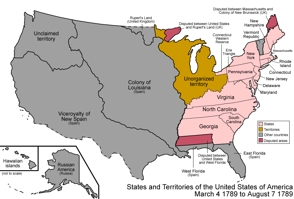
The following outline traces the territorial evolution of the U.S. State of South Dakota.

Outline

  • Historical territorial claims of the United Kingdom in the present State of South Dakota:
  • Rupert's Land, 1670–1870
  • Anglo-American Convention of 1818
  • Historical territorial claims of France in the present State of South Dakota:
  • Louisiane, 1682–1764
  • Treaty of Fontainebleau of 1762
  • Historical territorial claims of Spain in the present State of South Dakota:
  • Luisiana, 1764–1803
  • Third Treaty of San Ildefonso of 1800
  • Historical territorial claims of France in the present State of South Dakota:
  • Louisiane, 1803
  • Vente de la Louisiane of 1803
  • Historical political divisions of the United States in the present State of South Dakota:
  • Unorganized territory created by the Louisiana Purchase, 1803–1804
  • District of Louisiana, 1804–1805
  • Territory of Louisiana, 1805–1812
  • Territory of Missouri, 1812–1821
  • Unorganized territory formerly the northwestern Missouri Territory, 1821–1854
  • Treaty of Fort Laramie of 1851
  • Territory of Michigan east of Missouri River, 1805-(1834–1836)-1837
  • Territory of Wisconsin east of Missouri River, (1836–1838)-1848
  • Territory of Iowa east of Missouri River, 1838–1846
  • Territory of Minnesota east of Missouri River, 1849–1858
  • Territory of Nebraska west of Missouri River, (1854–1861)-1867
  • Territory of Dakota, 1861-1889
  • Land between the 43rd parallel north and Keya Paha River or Niobrara River was transferred to the State of Nebraska, 1882
  • State of South Dakota, since November 2, 1889
  • References

    Outline of South Dakota territorial evolution Wikipedia