
 | ||
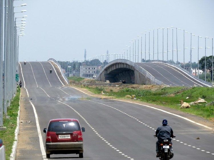
The Outer Ring Road is a major transport corridor being developed along the periphery of Chennai Metropolitan Area (CMA) by the Chennai Metropolitan Development Authority (CMDA). It is 62.3 km long connecting NH 45 (GST Road) at Vandalur, NH 4 (GWT Road) at Nazarathpet, NH 205 (CTH Road) at Nemillicherry, Tiruninravur to NH 5 (GNT Road) at Nallur and TPP road at Minjur. On 29 August 2010, the then Tamil Nadu Deputy Chief Minister M. K. Stalin laid the foundation for the first phase of the project from Vandalur to Nemillicherry, Tiruninravur covering a distance of 30 km.
Contents
- Map of Chennai Outer Ring Rd Tamil Nadu
- Phases
- Phase 1
- Segment I
- Segment II
- Phase II
- Segment III
- Planned Developments PPP mode
- High Growth Zone
- Auto Main Street
- Residential Areas
- Warehouse
- Logistics Park
- Project Status
- References
Map of Chennai Outer Ring Rd, Tamil Nadu
Phases
The Project is being developed in 2 phases with 2 segments each.
Phase 1
The Phase 1 of the project covers a distance of 29.65 km. 10 Grade separators at major junctions have been planned along this route. It also includes 50 bus bays on both sides and also truck lay-byes for parking of around 100 trucks. The Phase I project is being implemented by GMR, and the project is expected to be completed by June 2012. Phase I is thrown open to public on 29 August 2014, by the present Chief Minister of Tamil Nadu, through Video conferencing.
Segment I
The Segment I extends from GST Road (Vandalur) to NH4 (Nazarathpet) covering a distance of 19.7 km. The development covers an area of about 265.38 Hectares.
Segment II
The Segment II extends from NH4 (Nazerathpet) to CTH Road (Nemillicherry, Tiruninravur) covering a distance of 9.5 km. The development covers an area of about 140.9 Hectares.
Phase II
The Phase 2 covers a distance of 33.1 km.
Segment III
The Segment III extends from CTH Road Nemillicherry, Tiruninravur to GNT Road (Nallur)covering a distance of 18.8 km. The development covers an area of about 258.02 Hectares.
Planned Developments (PPP mode)
Price Waterhouse Coopers (PWC) has done a micro market study on the development of 50 m along the road. It has suggested that the components of the development could include a 5-star hotel, retail segments – including an "auto main street" where the ORR connects industrial suburbs that house automobile giants such as Hyundai, Ford and Renault Nissan – and facilities like multiplex, residential, hospital, commercial, warehouse and green spaces. Developers would be identified through open competitive bidding for these projects.
High-Growth Zone
The region close to NH-45 is seen as a high-growth area covering the Chennai neighbourhoods places Vandalur, Mannivakkam, Mudichur, Malayambakkam-Mangadu, MINJUR and PONNERI (Smart City). This would be the location for a 5-star hotel.
Auto Main Street
Localities near Minjur and Ponneri, which are hubs of automobile and component industries, would be the ideal locale for the auto main street, which is a niche retail for the automobile industry for which about 50 acres (200,000 m2) have been earmarked.
Residential Areas
Residential areas have been planned for more than 150 acres near MINJUR, PONNERI while residential spaces have been planned at Malayambakkam,NAZARATHPET, AGARAMEL and Poonamallee Three Star Hotels and Multi plus apartments are planned at Malayambakkam ( Sri Srinivasa Nagar )
Warehouse
A major warehouse has been planned in Minjur,Nemilichery (near Tiruninravur).
Logistics Park
Pattabiram would have a logistics facility.
Project Status
June 2015: