
Country United States FIPS code 29-54938 Elevation 220 m Zip code 64077 Local time Sunday 10:39 PM | Time zone Central (CST) (UTC-6) GNIS feature ID 0723850 Area 3.47 km² Population 821 (2013) Area code 816 | |
 | ||
Weather 9°C, Wind NE at 10 km/h, 83% Humidity | ||
Orrick is a town in Ray County, Missouri, United States. The population was 799 at the 2010 census.
Contents
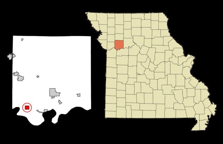
Map of Orrick, MO 64077, USA
History
The first community in the area was Albany when it was established by Ely Carter in 1854. When he applied for a Post Office it was denied because there was another Albany, Missouri already in the state and he used the name of his wife Ada for the post office but still continued to call the town Albany.
"Bloody Bill" Anderson was killed during the American Civil War during the Battle of Albany on October 24, 1864.
Albany formally incorporated in 1871 however by then St. Louis, Kansas City and Northern Star railroad (the Wabash Railroad) laid tracks a mile south in 1868 and 1869 and a new community of Orrick sprung up around them.
Orrick itself was laid out by the railroad and was named in honor of W. W. Orrick who had drawn up the plat. Orrick was incorporated in 1873.
Tornadoes
On January 24, 1967 an unusual winter tornado outbreak destroyed the town's high school killing two students.
On May 10, 2014 a Severe Weather Outbreak spawned a Tornado just southwest of Orrick. As the Tornado was heading towards Orrick it gained strength becoming an EF-3 as it went through Orrick.
Geography
Orrick is located at 39°12′45″N 94°7′25″W (39.212583, -94.123699). According to the United States Census Bureau, the city has a total area of 1.34 square miles (3.47 km2), all of it land.
2010 census
As of the census of 2010, there were 837 people, 319 households, and 221 families residing in the city. The population density was 624.6 inhabitants per square mile (241.2/km2). There were 364 housing units at an average density of 271.6 per square mile (104.9/km2). The racial makeup of the city was 97.7% White, 0.2% African American, 0.4% Native American, 0.1% Asian, 0.2% from other races, and 1.3% from two or more races. Hispanic or Latino of any race were 2.3% of the population.
There were 319 households of which 41.7% had children under the age of 18 living with them, 52.0% were married couples living together, 13.8% had a female householder with no husband present, 3.4% had a male householder with no wife present, and 30.7% were non-families. 25.7% of all households were made up of individuals and 10.1% had someone living alone who was 65 years of age or older. The average household size was 2.62 and the average family size was 3.20.
The median age in the city was 35.2 years. 30.8% of residents were under the age of 18; 7.5% were between the ages of 18 and 24; 27.4% were from 25 to 44; 24.4% were from 45 to 64; and 9.8% were 65 years of age or older. The gender makeup of the city was 47.7% male and 52.3% female.
2000 census
As of the census of 2000, there were 889 people, 340 households, and 246 families residing in the town. The population density was 649.9 people per square mile (250.5/km²). There were 372 housing units at an average density of 271.9 per square mile (104.8/km²). The racial makeup of the town was 98.43% White, 0.67% Native American, and 0.90% from two or more races. Hispanic or Latino of any race were 1.69% of the population.
There were 340 households out of which 39.1% had children under the age of 18 living with them, 55.3% were married couples living together, 13.8% had a female householder with no husband present, and 27.4% were non-families. 23.5% of all households were made up of individuals and 9.1% had someone living alone who was 65 years of age or older. The average household size was 2.61 and the average family size was 3.10.
In the town the population was spread out with 29.8% under the age of 18, 8.3% from 18 to 24, 32.3% from 25 to 44, 18.4% from 45 to 64, and 11.1% who were 65 years of age or older. The median age was 33 years. For every 100 females there were 96.2 males. For every 100 females age 18 and over, there were 94.4 males.
The median income for a household in the town was $37,500, and the median income for a family was $44,205. Males had a median income of $32,250 versus $21,198 for females. The per capita income for the town was $15,215. About 10.6% of families and 10.0% of the population were below the poverty line, including 17.0% of those under age 18 and 6.7% of those age 65 or over.
Education
The high school football team, the Orrick Bearcats won Missouri state high school football championships in 1975, 2007 and 2008.