
Country United States Area code(s) 207 Elevation 79 m Population 2,225 (2010) | Time zone Eastern (EST) (UTC-5) FIPS code 23-55505 Zip code 04472 Local time Sunday 6:34 PM | |
 | ||
Weather 2°C, Wind S at 10 km/h, 31% Humidity | ||
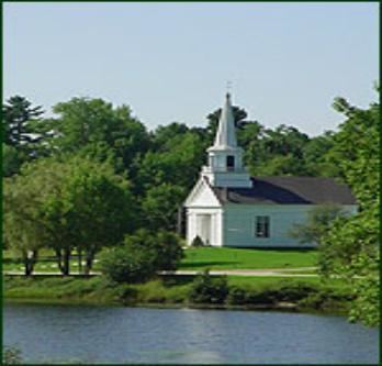
Wreaths across america 2016 orland maine 10 40 a m
Orland is a town in Hancock County, Maine, United States. The population was 2,225 at the 2010 census.
Contents
- Wreaths across america 2016 orland maine 10 40 a m
- Map of Orland ME USA
- Orland whatever race in orland maine 1976
- Geography
- 2010 census
- 2000 census
- Notable people
- Town government
- References
Map of Orland, ME, USA
Orland whatever race in orland maine 1976
Geography
According to the United States Census Bureau, the town has a total area of 52.87 square miles (136.93 km2), of which 47.04 square miles (121.83 km2) is land and 5.83 square miles (15.10 km2) is water.
2010 census
As of the census of 2010, there were 2,225 people, 976 households, and 627 families residing in the town. The population density was 47.3 inhabitants per square mile (18.3/km2). There were 1,470 housing units at an average density of 31.3 per square mile (12.1/km2). The racial makeup of the town was 97.3% White, 0.1% African American, 0.5% Native American, 0.3% Asian, 0.5% from other races, and 1.3% from two or more races. Hispanic or Latino of any race were 1.2% of the population.
There were 976 households of which 24.3% had children under the age of 18 living with them, 50.7% were married couples living together, 9.0% had a female householder with no husband present, 4.5% had a male householder with no wife present, and 35.8% were non-families. 27.9% of all households were made up of individuals and 8% had someone living alone who was 65 years of age or older. The average household size was 2.25 and the average family size was 2.70.
The median age in the town was 47.3 years. 17.3% of residents were under the age of 18; 7.9% were between the ages of 18 and 24; 20.5% were from 25 to 44; 38.5% were from 45 to 64; and 15.7% were 65 years of age or older. The gender makeup of the town was 50.0% male and 50.0% female.
2000 census
As of the census of 2000, there were 2,127 people, 867 households, and 630 families residing in the town. The population density was 45.5 people per square mile (17.6/km²). There were 1,253 housing units at an average density of 26.7 per square mile (10.3/km²). The racial makeup of the town was 98.27% White, 0.14% Native American, 0.23% Asian, 0.09% from other races, and 1.27% from two or more races. Hispanic or Latino of any race were 0.37% of the population.
There were 880 households out of which 31.5% had children under the age of 18 living with them, 57.4% were married couples living together, 9.7% had a female householder with no husband present, and 28.4% were non-families. 22.2% of all households were made up of individuals and 6.5% had someone living alone who was 65 years of age or older. The average household size was 2.42 and the average family size was 2.82.
In the town, the population was spread out with 24.0% under the age of 18, 5.7% from 18 to 24, 29.6% from 25 to 44, 27.8% from 45 to 64, and 12.8% who were 65 years of age or older. The median age was 40 years. For every 100 females there were 98.9 males. For every 100 females age 18 and over, there were 92.3 males.
The median income for a household in the town was $39,345, and the median income for a family was $45,875. Males had a median income of $36,435 versus $23,571 for females. The per capita income for the town was $19,551. About 8.5% of families and 11.2% of the population were below the poverty line, including 18.3% of those under age 18 and 4.2% of those age 65 or over.
Notable people
Town government
Selectmen/Town Meeting